What is a Map?
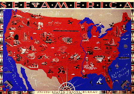
When we think of maps, the first image that pops into our minds is usually a drawing or picture that shows some part of the Earth’s surface, like the image below. If we think about it some more, we may recall that there are may kinds of maps: maps of the hallways or classroom locations at our schools, maps of bus routes or subway routes in our towns, of maps of constellations in the sky.
These examples show that a map is a representation (usually two-dimensional, or flat) of any surface or area. Here is a map made by a Chickasaw Indian around 1723 for Francis Nicholson, the Governor of British Carolina. It may not look like a map to you, but it contains all the basic elements found on any map. What are these elements?
Direction All maps indicate direction: which way are things located? Direction is often indicated relative to the orientation of the map, where one edge is “up” and the opposite edge is “down.” Directions sometimes correspond to the major points of a compass (North, East, South, and West). How is direction indicated on this map? (Hint: the long line on the map’s left-hand side is the Mississippi River, and the long line along the bottom of the map is the Gulf Coast.) This map is oriented to compass directions; the top edge is North. Distance Maps also usually indicate distance: how far apart are things shown on the map? Absolute distances are indicated by a scale (for example, 1 map cm. equals 1000 m on the ground). Distance can also be indicated in a relative manner by how closely or how far apart separate elements are placed on a map. How is distance indicated on this map? Relative distances are indicated on this map. Look at the large circles representing Indian towns. These are separated by relative distances; the closer the circles, the shorter the real distance separating them.
Content All maps are made to show what is located in the area that’s represented. The content of this Southeastern Indian map includes topographic features (rivers and coastlines), a set of closely related Indian and English settlements (indicated by the large circles), a larger set of other communities that are more distant geographically as well as socially (indicated by smaller circles; the ones marked with an “F” are Indian villages allied with French colonists), and pathways or trails connecting these settlements. See if you can identify the following items:
|
||||
 |

|

![“A Map describing the situation of several Nations of Indians between South Carolina and the Massisipi …” Courtesy of the Public Record Office, London [CO 700/6(2)]. All rights reserved, further reproduction is prohibited.](images/AIH_indianMap.jpg)