Bluff Shelter News

Walker Shelter in Bella Vista

Lydia Rees (ARAS staff) at Walker Shelter in Bella Vista.

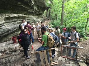
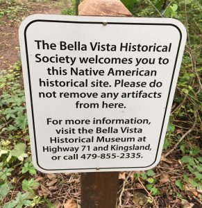
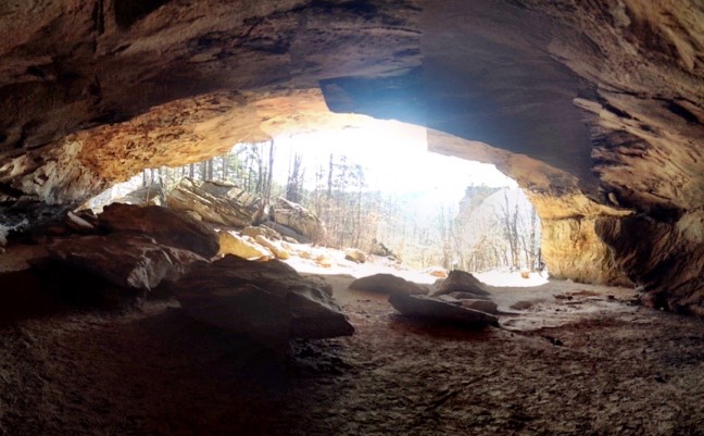
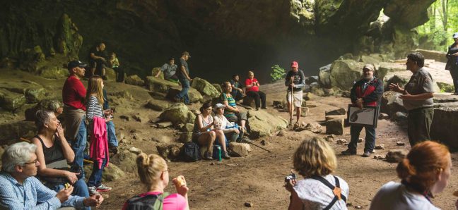
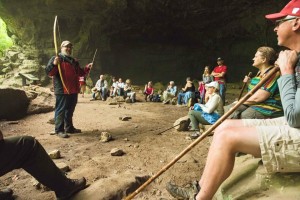
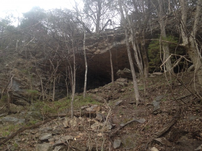
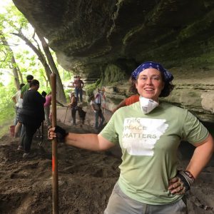
The Arkansas Archeological Survey (ARAS) staff respond to several bluff shelter looting incidents every year.  This year, the most extensive was our salvage work at Walker Shelter in Bella Vista.  The Bella Vista Historical Museum contacted the ARAS-UAF Research Station regarding preventing further looting at an impressive shelter along the Bella Vista Back 40 trail system.  This trail had been the target of much looting activity prior to the trail opening in the fall of 2016, and it was the Museum’s hope that we could assist with documenting the damage and helping to deter subsequent looting.

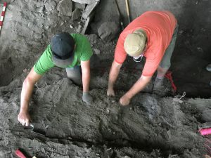
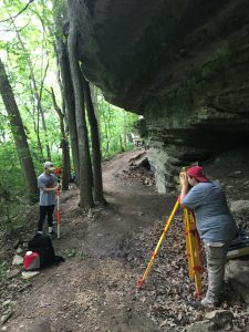
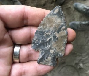
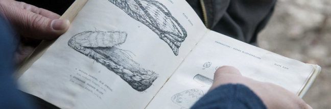
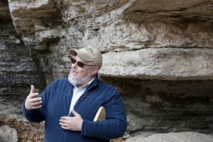
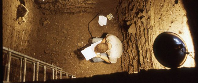
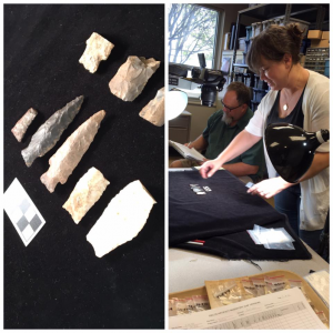
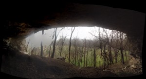
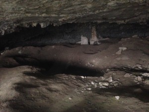
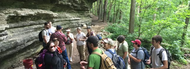
This June, as a side-project of the 2017 University of Arkansas archeological field school, 10 students and several members of the ARAS staff visited Walker Shelter.  We created a detailed site map, documented the looting and conducted salvage excavations along the looted areas.  At least a meter and a half of archeological deposits were documented―including the recovery of a Middle Archaic Calf Creek projectile point.  The looters pits were backfilled and the Museum has plans for further sterile fill and signage at the site…we are also planning a guided hike to the shelter and a lecture about the importance of bluff shelters as an endangered resources in the fall–stay tuned.

The 2017 University of Arkansas archeological field school arrives at Walker Shelter in Bella Vista after a brisk hike in.
Kayden Dennis (UofA Anthropology undergraduate) and Jared Pebworth (ARAS) documenting looter disturbance and identifying intact deposits at Walker Shelter.
Victoria Jones (UofA graduate student) and Jamie Middleton (UofA Honors undergraduate) mapping Walker Shelter.
Late Archaic projectile point recovered from the base of the looter disturbance at Walker Shelter.
Signage placed at Walker Shelter in order to help deter looting.

Bluff Shelter Talk at UCA

On Thursday, November 17th Dr. Jamie Brandon and Lydia Rees will give a public talk entitled “Beyond the Bluff Dweller: Isolation and Connection in Prehistoric Bluff Shelters of the Arkansas Ozarks” on the University of Central Arkansas campus in Conway.  The talk will be held in the UCA College of Business Auditorium at 6:30 pm and is sponsored by the UCA Department of Sociology, Criminology and Anthropology as a part of the college’s Native American Heritage Month events.

bluff-poster
Poster for the UCA talk. Click for a larger image.

This is just one stop in the fall 2016 “Beyond the Bluff Dweller” tour which has included talks at the Boone County Museum in Harrison (8/29), the state-wide Arkansas Archeological Society meeting (10/01) and several Society Chapters (Arkhoma Chapter, 9/15 and Tunican Chapter, 10/04), the North Central Chapter of the Arkansas Master Naturalists at Bull Shoals Lake (9/17), the Ozark Symposium (9/24), and the Tahlequah Archeological Society in Oklahoma (10/04).  Following the UCA talk this month, the final stop on the Fall 2016 “Beyond the Bluff Dweller” tour will be a talk to the Ko-ko-ci Chapter of the Arkansas Archeological Society in Fayetteville, AR on December 13.

For more information, contact Dr. Duncan McKinnon, UCA Department of Sociology, Criminology and Anthropology.

Dating Saltpeter Cave


The Arkansas Archeological Survey conducted excavations at Saltpeter Cave in Newton County in 1969 and 1970—the very early years of the organization.  Ken Cole, the first Research Station Archeologist stationed at Arkansas Tech (then Arkansas Polytechnic College) conducted two seasons of excavation into this shelter that had been previously visited by Dellinger’s crews in 1934.  Cole excavated nine test units, the deepest of which contained almost 14 feet (4.11 meters) of archeological deposits representing at least 9,000 years of Arkansas history.

This deep, stratified deposit is all the more important to researchers as it is one of the few deep Arkansas bluff shelters investigated using modern excavation techniques.  Thus, unlike the materials from the Dellinger excavations of the 1930s, we have detailed stratigraphic records, along with approximately 450 diagnostic hafted bifaces, and 42 un-dated radiocarbon samples.  Unfortunately, Cole left the Arkansas Archeological Survey shortly following these excavations, leaving this collection curated, but largely untouched for 47 years.

picture1
Jared Pebworth and Lydia Rees photograph diagnostic bifaces from Saltpeter cave.

Jared Pebworth and Lydia Rees have begun to photograph the diagnostic lithic tools just focusing on the deepest unit—Test Unit E.  If you just flick through the photographs by level of these hafted bifaces you can literally see some of the type transitions we are going to be able to explore with this collection.

Over the course of the next year, we hope use the Salt Peter collection to address some questions about Ozark chronology—particularly of the Early and Middle Archaic periods.  This is much needed as many of these points types are, to this day, dated by a single, or relatively few, radiometric dates.  The deep, stratified deposits at Salt peter Cave offer us an opportunity to analyze a cross-section of Ozark prehistory.

We received a start on our efforts to date this remarkable collection in the form of a grant from the Archeological Research Fund of the Arkansas Archeological Society.  This will allow us to pay for one radiocarbon date associated with a projectile point from test unit E from the Saltpeter site.  We will keep you posted on what we find out.  We will also keep looking for additional funding to run more dates from this site.

Public Hike at Indian Rockhouse Cave

Photo Apr 29, 1 14 56 PM
On the trail to Indian Rockhouse Cave.

On April 30, 2016, we had the honor of helping out our National Park Service colleagues with a hike and archeological tour of Indian Rockhouse Cave on Panther Creek in the Buffalo National River. We were asked to help after the park received a flood of interest in the event via advertising on social media. There was some concern that the numbers would overwhelm the staff. It was a great opportunity to talk about the archeology of bluff shelters in a spectacular setting.  Dr. Jamie Brandon talked about the chronology of bluff shelter occupation and showed off some replicas of the kind of technology used by the native Americans who used these shelters in prehistory.  Despite the damp weather the hike was a success and we look forward to giving more presentations in the Buffalo National River in the future.

TerraFondriest2
Jamie Brandon talks about bluff shelters in a bluff shelter.


2016 AHA, Little Rock

The Arkansas Ozark bluff shelter project was represented at the 75th annual conference of the Arkansas Historical Association in Little Rock.  Dr. Jamie Brandon and Lydia Rees co-presented their paper which explored the construction of the “Bluff-dweller Culture” in the 1920s-30s and how, because of intellectual traditional and historical trajectories, this has led to misconceptions of the nature of Ozark prehistory throughout the twentieth century.

When early archeologists, like M. R. Harrington and Samuel Dellinger, deployed the “Bluff-dweller Culture” concept, they were collapsing 9,000 years of history into one cultural entity.  The modern timeline of southeastern prehistory had yet to be written when they were working in the 1920s and 1930s so this error is understandable.  The problem is that it has taken decades to shed the perceptions set up by this older model.  It has led to the idea of a backwards and isolated Ozark prehistory that is not supported by current research.  The paper presented at the conference, and which has been submitted for publication aims to counter this older narrative with newer information.

AHA2016a

Visit to Snowball or Slay Cave

On March 18 & 19 we visited Marshall, Arkansas.  Dr. Brandon gave an evening talk at the Searcy County Historical Society about bluff shelter archeology on Friday night, and the talk was well received with a great turnout.  The following day, Brandon and Rees visited several sites in the area—including Snowball or Slay Cave.

Many archeologists who work in the mid-content are familiar with the distinctive Calf Creek point, a Early and/or Middle Archaic stone projectile point with deep, narrow basal notches.  Those points, and presumably the Archaic culture that produced them were originally defined by Don Dickson in 1968 based on his excavations at “Calf Creek Cave.”

IMG_9677
Wide-angle view out of the mouth of Snowball or Slay Cave.

“Calf Creek Cave” is only one of the many names given to what locals call “Snowball Cave”—named after the nearby community of Snowball, Arkansas—or “Slay Cave” named after an early landowner.

In the 1940s there are reports of a “7-foot-tall Indian Woman” being excavated from the cave, but you can check out our discussion of myths and misconceptions about Ozark bluff shelters to see why this is not the case.

Unfortunately for contemporary researchers, this cave—although spectacular—has been extensively disturbed by looting.  Even by 1968, our site records say “forget about Snowball Cave.”  It is very doubtful that intact deposits remain.  This is one more example of important archeological data destroyed by looting.

IMG_9671
Giant holes from decades of looting at Slay Cave.