Archeogeophysical Surveying at 3PP274
George Sabo III, Jami J. Lockhart, and John Samuelsen
Arkansas Archeological Survey
During the 2009 Arkansas Archeological Society training program excavations at 3YE347, the Survey professional staff was contacted by Mr. David Peak, of Galla Rock, Arkansas, who owns property directly across the Arkansas River from the Carden Bottoms locality. An archeological site on his property (3PP274) had been surveyed in 1987 by Archeological Assessments, Inc., and visited again in 1991 by Dr. Skip Stewart-Abernathy of the Arkansas Archeological Survey. Mr. Peak hoped that one of us could visit his home to provide information on a collection of artifacts from the site gathered during the course of farming activities. A few days later, George Sabo and Leslie Walker visited Mr. Peak to examine the collection and make a quick tour of several sites in the locality.
|
|
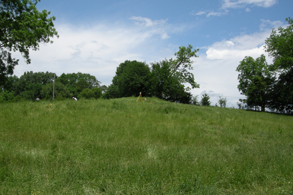
Mound feature at 3PP274.
|
Based on the materials in the collection and information provided by Mr. Peak concerning the history of local land use practices, Sabo and Walker decided that further investigations at 3PP274 could provide a valuable contribution to the NEH-funded investigation of sites in the Central Arkansas River Valley. Of particular interest was an intact mound that appeared to be of aboriginal origin. Consequently, arrangements were made to revisit the site to assess prospects for further work.
|
|
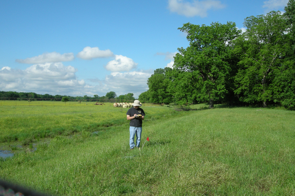
George Sabo recording GPS coordinates for a grid point. |
In early May 2010, George Sabo, Jami Lockhart, Jerry Hilliard, and Leslie Walker conducted a follow-up survey of the site. They identified several promising areas for archaeogeophysical surveying and recorded a series of GPS coordinates for preliminary mapping. The instrument survey was conducted on May 17–18 by a project crew consisting of Sabo, Lockhart, Hilliard, and Walker, accompanied by Skip Stewart-Abernathy and Larry Porter (AAS-WRI research station), Tim Mulvihill (UA-Fort Smith research station), John Samuelsen and Duncan McKinnon (Survey Coordinating Office), and Adam and Rebecca Wiewel (UA Anthropology graduate students). In addition to the instrument survey, we examined erosion cuts along the side of the mound in which we verified artificial deposits.
|
|
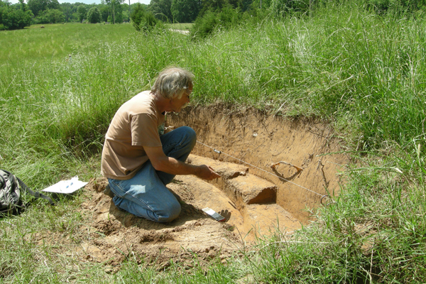
Larry Porter examines mound sediments exposed in a erosional feature.
|
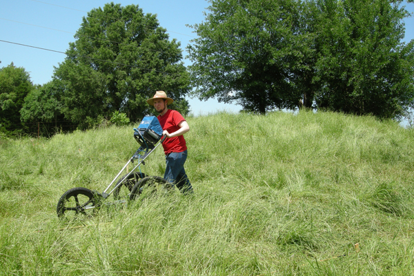
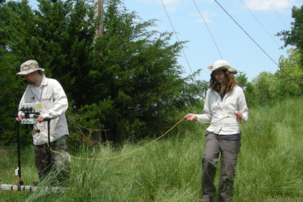
An area measuring 60 x 60 meters, containing the suspected mound feature and surrounding landforms, was divided into 20-meter grid units for topographic surveying using a robotic total station. An instrument survey using gradiometry, ground penetrating radar, and electrical resistivity was then conducted over most of this area, resulting in discovery of a series of anomalies registering increased magnetism and electrical resistance.
|
|
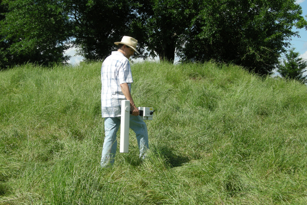
Jami Lockhart conducting a gradiometer survey.
|
|
|
John Samuelsen conducting a ground penetrating radar survey.
|
|
|
Adam and Becky Wiewel conducting a resistivity survey.
|
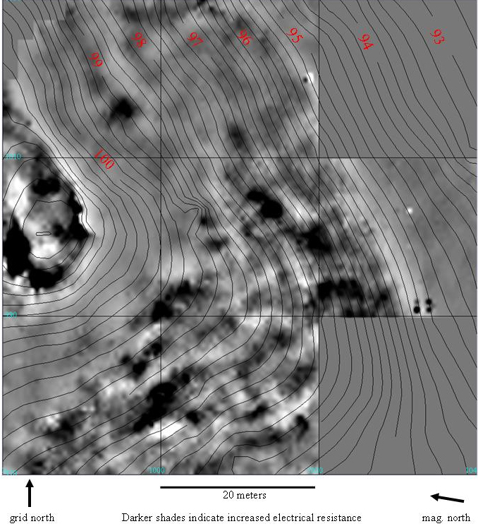
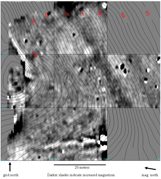
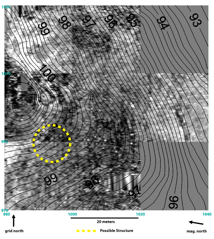
Based on instrument surveys and follow-up excavations conducted at other sites in our study area, we strongly suspect that these anomalies represent areas of artificial mound fill, excavated pits refilled with a mixture of trash and sediments, possible midden areas (buried surface trash accumulations), and collapsed building remains. A possible circular structure was identified in the GPR survey just off the southwestern edge of the mound. Additional instrument surveys and excavations at this site are scheduled for summer and fall of 2010.
|
|
Buried anomalies (dark patches) detected in the resistivity survey.
|
|
|
Buried anomalies (dark patches) detected in the gradiometry survey.
|
|
|
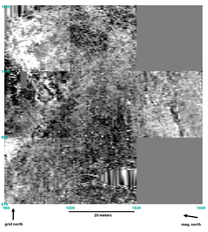
Raw image of buried anomalies (approximately 50 cm below surface) detected in the ground penetrating radar survey. Note possible circular structure detected just southwest of the mound on lower left corner of the image.
|
|
|
Buried anomalies (approximately 50 cm below surface) detected in the ground penetrating radar survey, showing elevation isolines and possible circular structure (outlined in yellow) just southwest of the mound.
|
|