

 |
|||
Archeogeophysical Surveying at 3YE25
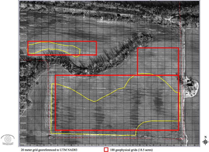
Arkansas Archeological Survey Extending immediately to the west of the McClure site (3YE347) is another site designated 3YE25. The two sites actually represent a single large habitation and cemetery complex in the Carden Bottoms, separated today by a dirt farm road running north to south. This complex was one of the centers of early 20th-century looting activities. During the summer of 2009, the National Resource Conservation Service (NRCS) and Department of Arkansas Heritage notified the Arkansas Archeological Survey of plans to take most of 3YE25 out of agricultural cultivation to be planted in hardwoods, thereby creating a long-term conservation area. In keeping with the widely acknowledged importance and unique nature of the site, the NRCS requested that the Survey provide an assessment of the impact area to be used in planning the locations of the hardwood stands so as to minimize disturbance of archeological features. The Survey agreed to take on this work as part of its NEH-funded investigation of sites in the Carden Bottoms locality. The NCRS provided the Survey with a hardcopy map delineating specific areas of concern with regard to the proposed tree planting operation. The hardcopy map was digitized as a data layer and georeferenced to the UTM NAD83 coordinate system within the Survey’s previously-constructed Carden Bottoms GIS.
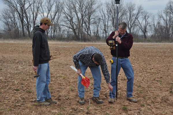
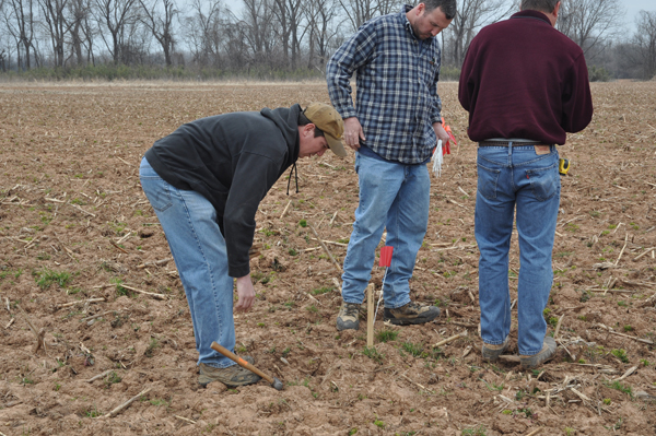
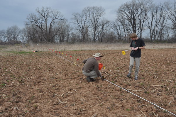
The Survey then developed and submitted planning maps to NCRS delineating the number and location of geophysical grids needed to encompass and adequately test the areas of concern. We worked in the field on several days during March, 2010. Arkansas Archeological Survey crew members included Mike Evans, Jerry Hilliard, Aden Jenkins, Duncan McKinnon, Tim Mulvihill, Larry Porter, George Sabo, John Samuelsen, and Skip Stewart-Abernathy. John Riggs and Diana Angelo of NCRS also joined us, along with several members of the Arkansas River Valley chapter of the Arkansas Archeological Society. First, we extended the site grid developed for the eastern portion of the site (3YE347) across to the western, or 3YE25, area. We used a robotic total station to set a grid with wooden stakes at 20 meter intervals. Then we used tapes to set pin flags at one meter intervals for the gradiometer survey. We also used the total station to collect high-accuracy horizontal and vertical data to produce a close-interval topographic map.
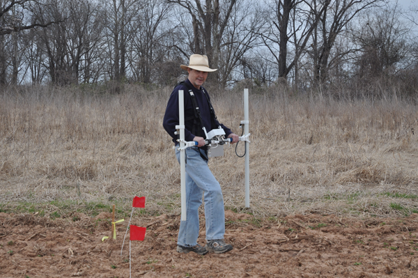
Next we conducted an extensive gradiometer survey over the entire gridded area of the site. We collected gradiometer data for 194 twenty-meter grid units encompassing a total area of more than 19 acres (7.76 hectares) identified as areas of concern for the proposed tree-planting operation.
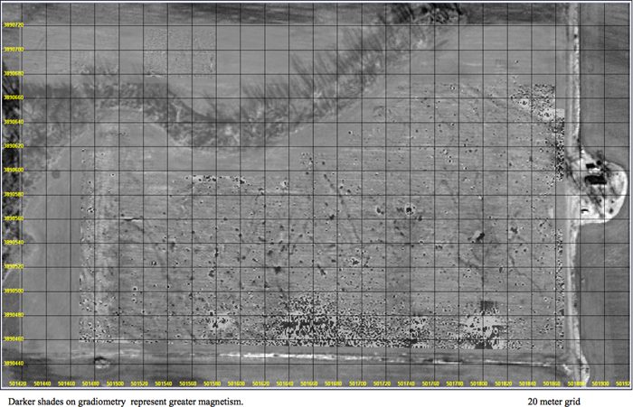
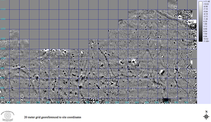
As was the case for 3YE347, numerous magnetic anomalies are apparent in the resulting geophysical imagery. The material composition of some of the anomalies can be identified as metal due to a characteristic magnetic signature known as a dipole, which is composed of a relatively high magnetic reading consistently paired with relatively low reading. This phenomenon is most apparent in an alignment along the extreme southern portion of the impact area where tenant farmer or farm laborer houses were located during the early 20th century. It is also possible that bits of metal dating to the early historic (contact) period, and associated with archeological features on the site, may be producing some of the dipole readings.
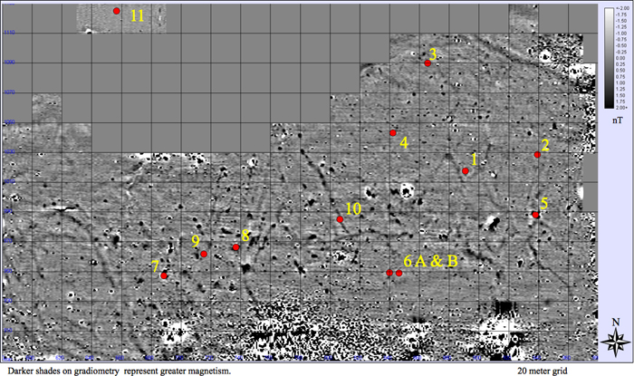
In addition to metal, there are numerous magnetic anomalies that are similar to those confirmed as archeological features at 3YE347 and on other sites that have been similarly tested in Arkansas.
Suspected cultural features at 3YE25 include pits, midden scatters or deposits, and building floors. Excavation of a sample of these features is planned for fall and winter, 2010. The image below shows several anomalies selected for excavation.
|
||||||||||||||||||
|


| Home | Introduction to CARV | Research Design | Project Accomplishments |