


 |
|||
Archeogeophysical Surveying at 3YE347
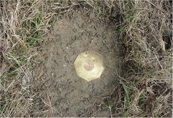
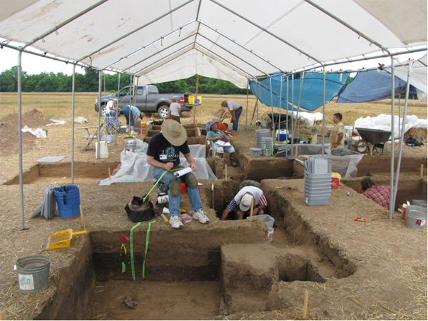
Arkansas Archeological Survey We began our program of archeogeophysical surveys at sites in the Carden Bottoms study area with work at the McClure site (3YE347). This site was tested in 1992-1994 by Survey research station archeologist Dr. Leslie (Skip) Stewart-Abernathy and members of the Arkansas River Valley chapter of the Arkansas Archeological Society. At that time, a large feature filled with cultural debris (artifacts, animal bone, and carbonized plant remains) was discovered and partially excavated. Most of the artifacts found during the excavations represent the ca. A.D. 1500 - 1700 Carden Bottoms phase. The presence of European trade goods in the feature, including brass and glass beads and an iron knife blade, indicates contact and interaction with European explorers. In light of these findings, and in relation to our current interest in further investigations at Carden Bottoms phase sites, plans were made to conduct additional excavations at the site as part of the June, 2009 Arkansas Archeological Survey/Arkansas Archeological Society training program. To provide additional guidance for the planned excavations, we began our work at the site in October, 2008. The Survey crew included Mike Evans, Jerry Hilliard, Aden Jenkins, Duncan McKinnon, Jared Pebworth, Larry Porter, George Sabo, Skip Stewart-Abernathy, Leslie Walker, and Rebecca Wiewel. Several Arkansas River Valley chapter members also came out to help. The first step was to create a permanent datum geo-referenced to the UTM NAD83 coordinate system. From this point we extended a comprehensive site grid system within which we can integrate past and future archeological survey and excavation areas. We then collected high-accuracy GPS coordinates for several key grid points. This enabled us to create a Geographic Information System (GIS) application for the project that includes high-resolution data layers including a 10-meter (x-y) digital elevation model for the site accompanied by geo-referenced true-color and color-infrared aerial photos.
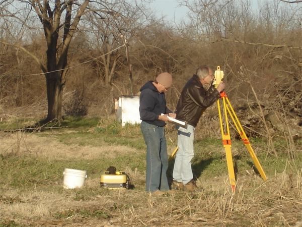
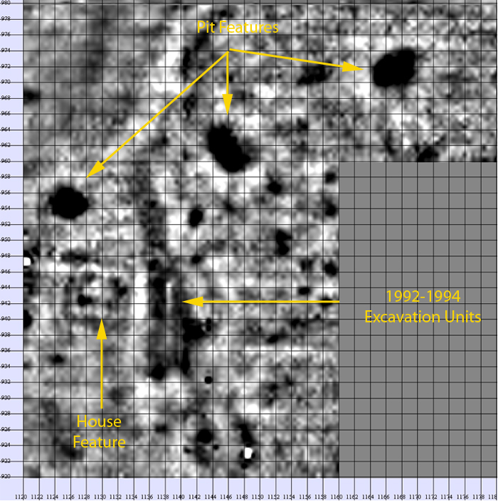
Returning to the site in February, 2009, we used a laser-driven total station to project the grid system from the permanent datum monument, establishing 20 meter grid points across the site. We marked the general location of Stewart-Abernathy’s previous excavations and selected several overlapping and adjacent areas for geophysical survey.
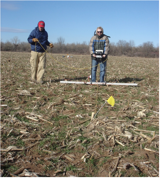
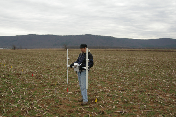
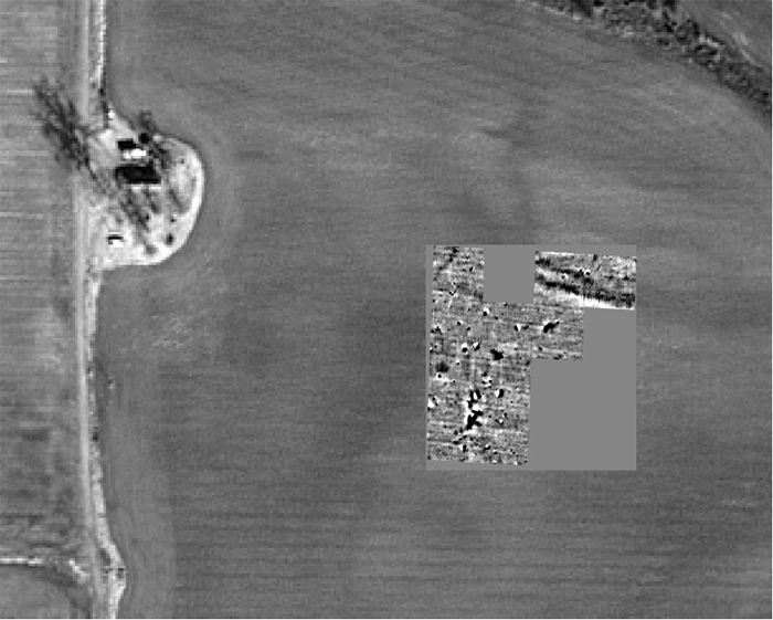
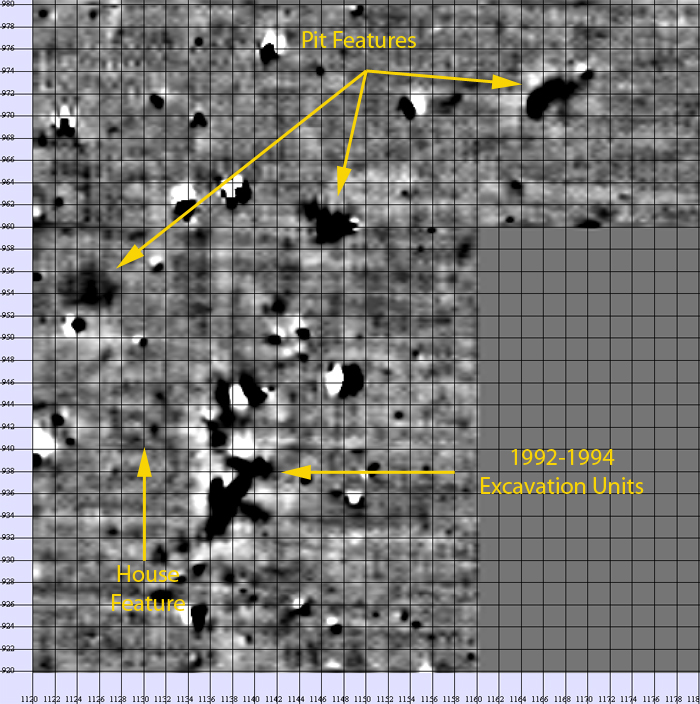
We then conducted gradiometer and electrical resistance surveys that revealed Stewart-Abernathy’s previously excavated test units along numerous other well-defined anomalies.
Exploratory, small-scale excavation units verified several of the anomalies as archeological features. One set of large, circular anomalies turned out to be refuse-filled pits. Another set of anomalies represent the floor area and associated debris scatters from a burned and collapsed building. These are the kinds of features we want to excavate to produce material evidence concerning Carden Bottoms phase lifeways.
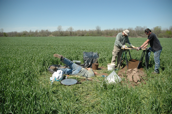
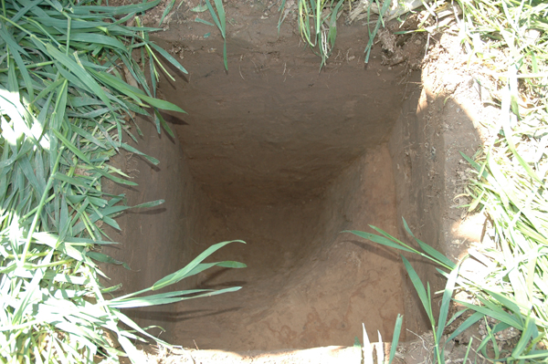
Excavations conducted during the June, 2009 training program concentrated on the refuse-filled feature identified during Stewart-Abernathy’s 1992-1994 preliminary work at the site. This turned out to be a natural ravine filled with trash from the adjoining occupation area. The excavations produced an excellent sample of Carden Bottoms phase material remains. Combined with the material collected during the 1992-1994 excavations, this is the first such assemblage acquired under modern, controlled excavation procedures.
Excavations of other residential features, including the building feature (which we suspect represents a dwelling) are planned for the fall of 2010. |
||||||||||||||||||||
|


| Home | Introduction to CARV | Research Design | Project Accomplishments |