3YE25 Excavations
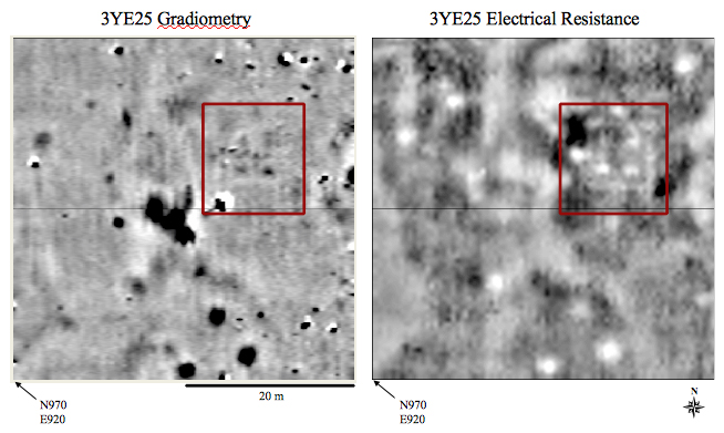
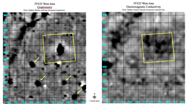
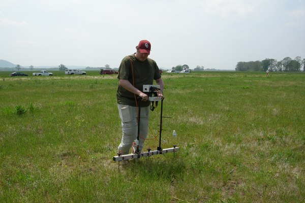
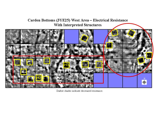
Arkansas Archeological Survey The primary objective of our Carden Bottoms excavations is to retrieve artifacts and preserved plant and animal remains from residential contexts, especially house and trash pit features. A combination of low and high resolution remote sensing surveys at 3YE25--the main locus of 1920s era looting that produced the museum collections we are studying--identified a large number of suspected houses and pits. Thus far, we have confirmed three houses and three pit complexes revealed in the remote sensing imagery by excavation in both the eastern and western areas of the site. Several more anomalies similar to those already excavated are evident as cardinally-oriented squares of decreased resistance corresponding to areas of increased conductivity. These square anomalies contain centralized magnetic features that are consistent with signatures for central hearths. The site thus appears to contain a far larger number of house features than initially suspected. Furthermore, these house features appear to be arranged in discrete neighborhoods, offering a prospect for addressing questions concerning site structure and community organization through time. These results indicate that 3YE25 is an extraordinary site, presenting an unparalleled opportunity to investigate the role of art, ritual, and social interaction among Carden Bottoms phase people. Consequently, we are directing much additional effort to its study.
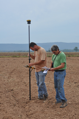
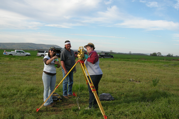
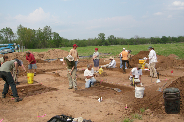
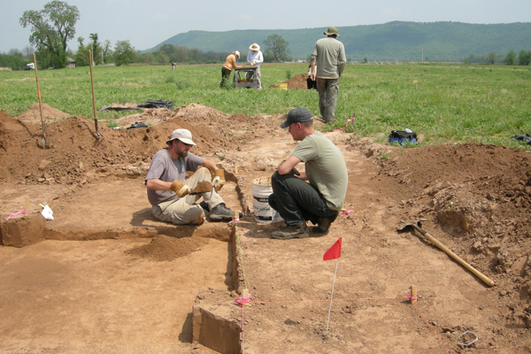
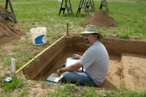
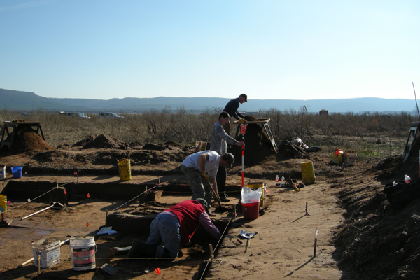
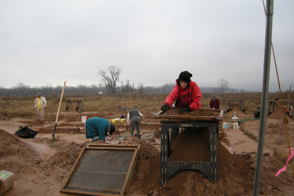
The following paragraphs summarize work completed to date at 3YE25. For all work reported below, excavation units are “shot in” to our master site grid system with a laser total station set up over a permanent datum monument that serves as a control point for both 3YE25 and 3YE347. Total station measurements for excavation units on the western side of the site, located several hundred yards from the permanent datum, are taken from a secondary datum located near the excavation units. Total station readings are taken for all horizontal and vertical data points (excavation levels, feature boundaries, artifact and sample locations, plan and profile mapping, etc.). Basic excavation documentation is facilitated by use of Arkansas Archeological Survey excavation level, profile, and feature forms, along with artifact and field sample, photo, feature, and total station log sheets. We use additional forms for special samples and other requirements, as needed. Photographs are taken with high resolution digital and black and white film cameras. October, 2010 We conducted the first round of excavations during two weeks in October, 2010, working in both the eastern and western areas of the site. The Arkansas Archeological Survey field crew consisted of George Sabo III, Jami Lockhart, Jerry Hilliard, Aden Jenkins, Jared Pebworth, Michael Evans, John Samuelsen, Leslie Walker, Duncan McKinnon, Larry Porter, and Skip Stewart-Abernathy. John Riggs and Diana Angelo of the Natural Resources Conservation Service also provided assistance, along with Arkansas Archeological Society members Anika and Onyx Brantley, Don Higgins, Jim Rees, Zach Shaddon, Alan Smith, and Missy Sorrels.
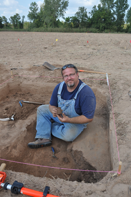
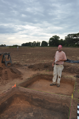
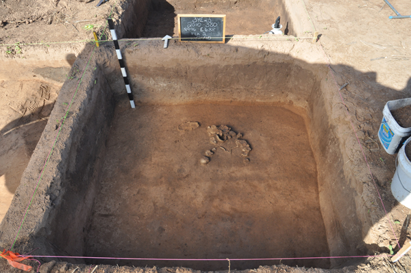
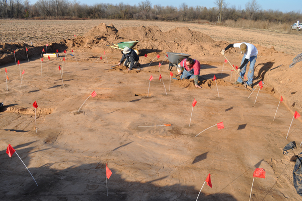
Excavations in the western part of the site began with three 2 x 2 meter units opened up over two suspected pit features and one possible house area (labeled Anomaly 7 in the 3YE25 Survey summary). In the first of these units, we identified an oval pit feature, designated Feature 1. This feature extended nearly a half meter in depth and was filled with household trash including animal bone, carbonized plant remains, stone artifacts, and an abundant amount of broken ceramics. The association of this material with a nearby house feature (below) will enable us to compare ceramics representing domestic assemblages with the whole vessels in museum collections. We will also be able to examine assemblage variability between individual households.
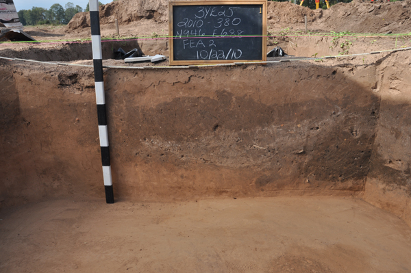
A second unit exposed another more extensive trash deposit containing the same kinds of material, labeled Feature 2. At first, this appeared to be another single pit feature, though it exhibited more complex stratification, including an undulating ash layer (from cleaning a hearth feature at a nearby house) in which we found exceptionally well-preserved animal and plant remains, including fish bones and scales. Excavation of adjacent 2 x 2 meter excavation units revealed that the Feature 2 pit was intersected by a second trash pit, designated Feature 25. Our excavations reached the bottoms of both pits in the excavated units. In the very bottom of the Feature 2 pit, we found a pile of discarded box turtle shells with mostly intact carapace and plastron sections.
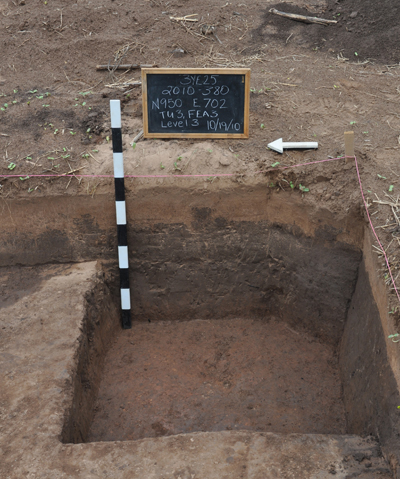
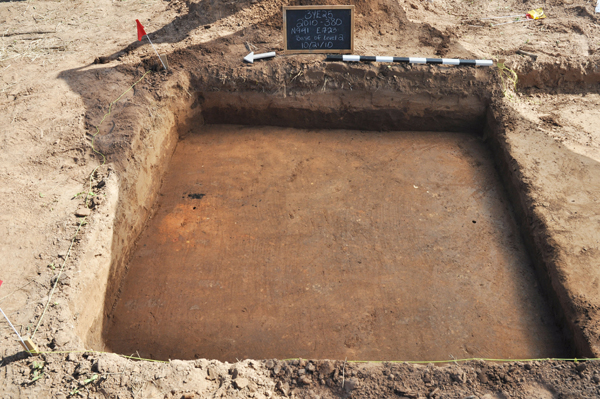
A third unit opened in the Anomaly 7 area came down on a very thick, dark sediment (Feature 3) that contained almost no artifacts or other remains. This dark sediment was underlain by sterile, light-colored silts. Though we failed to recognize a floor or any other feature in this unit, our best interpretation at this point—following the imagery produced by the geophysical survey—is that Feature 3 a house with a poorly preserved floor. We will give this house a number after additional excavations confirm our interpretation.
We opened up three additional 2 x 2 meter units several meters to the east of the Anomaly 7 area, over another suspected house feature identified in the remote sensing imagery. Here we uncovered an area of baked sediments associated with a hearth (Feature 19), a possible wall trench (Feature 20), and a line of four post molds (Features 21-24). We labeled this complex of features House 2. We retrieved a small sample of stone and ceramic artifacts from these excavation units and we found occasional bits of burned clay, but we identified no distinct floor features before we had to close down excavations in this area. We returned to this area in June, 2011 and excavated several additional units (see below).
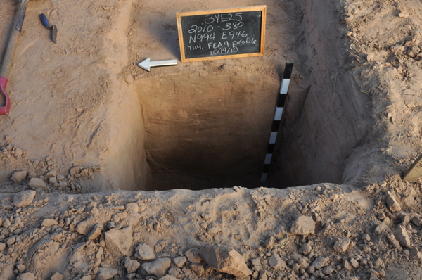
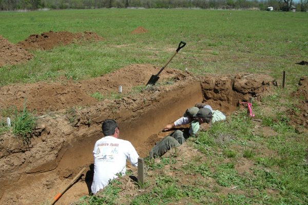
We also opened a series of 1 x 2 and 2 x 2 meter units over another suspected house feature in the Anomaly 5 area on the eastern edge of the site, located about 250 meters east of the Anomaly 7 area. Here, high resolution gradiometry and electrical resistivity imagery revealed a square structure with four interior roof support posts and a central hearth area. We opened the first unit over one of the interior roof support posts, which we identified (as Feature 4) in plan view just below the plow zone. The profile of this feature puzzled us at first; there were no clear lateral margins and there was a bulbous protrusion at the base. We later determined that the post had been yanked out of its hole, and then later (probably during the hey-day of looting at the site in the 1920s) somebody had dug a shovel hole into the post hole after probing it several times with a metal rod.
Next we opened up a 2 x 2 m unit over the southeast corner of the house where, sure enough, we identified a series of post molds (Features 6 – 10). Another 1 x 2 m unit excavated in the center of the house area exposed baked sediments representing the hearth (Feature 11). Finally, a 2 x 2 m unit over the northeast corner of the house revealed another set of post molds (Features 14 – 17). We labeled this feature complex House 1.
We encountered all of these features immediately beneath the plow zone, which extends from the present ground surface to a depth of 40 cm. We collected very few artifacts from the plow zone, found no intact floor level, and found no artifacts associated with any of the structural features. In short, decades of plowing across the site (including periodic sub-soil plowing) has destroyed the original floor of the house, leaving intact only the bottoms of post features that penetrated beneath the floor level. Even with this level of destruction, it is remarkable that the location of this house shows as well as it does in the geophysical survey imagery. December, 2010 We returned to the site in December, 2010, for another two-week session undertaken to complete the excavation of House 1. The same Survey field crew less John Samuelsen but plus Marion Haynes participated in these excavations, along with John Riggs (NRCS) and Arkansas Archeological Society members Don Higgins, Jim Rees, and Alan Smith. Drs. Scott Hammerstedt and Amanda Regnier of the Oklahoma Archeological Survey also visited and kindly helped us out for part of the week.
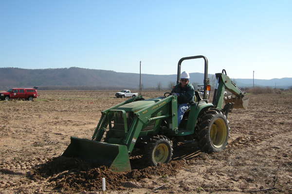
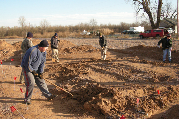
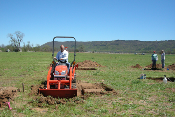
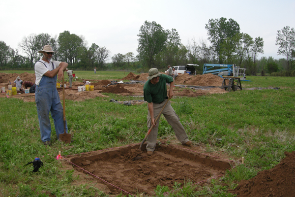
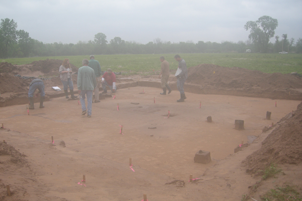
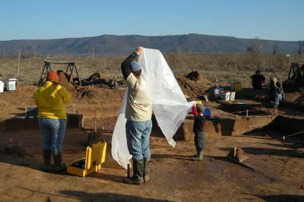
John Riggs arranged for a tractor with a front-end loader to remove most of the plow zone sediments above the preserved house features. We removed the remaining plow zone by hand to the expose all House 1 post mold and pit features.
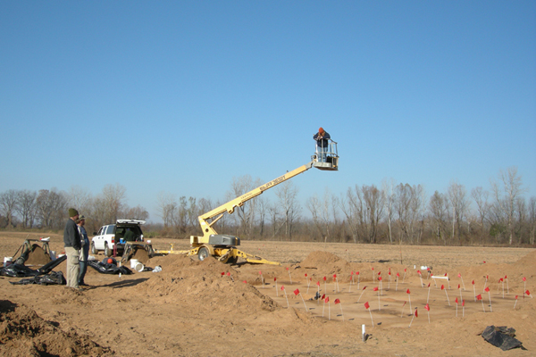
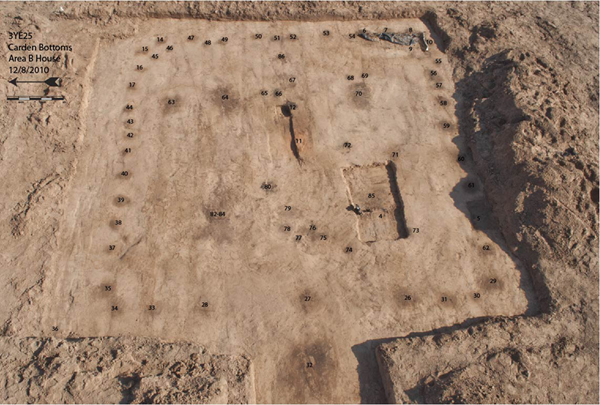
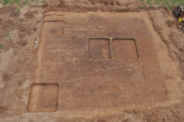
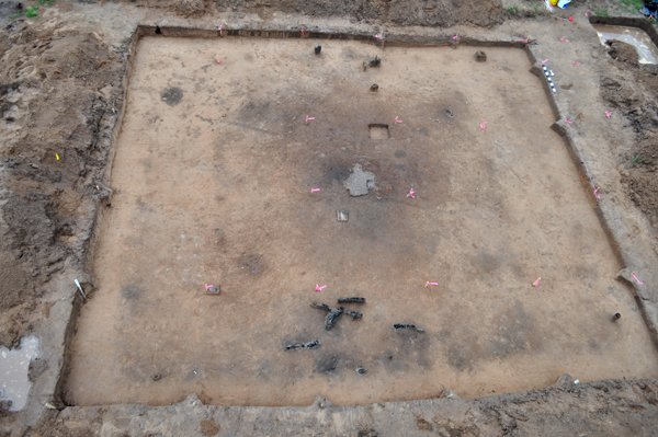
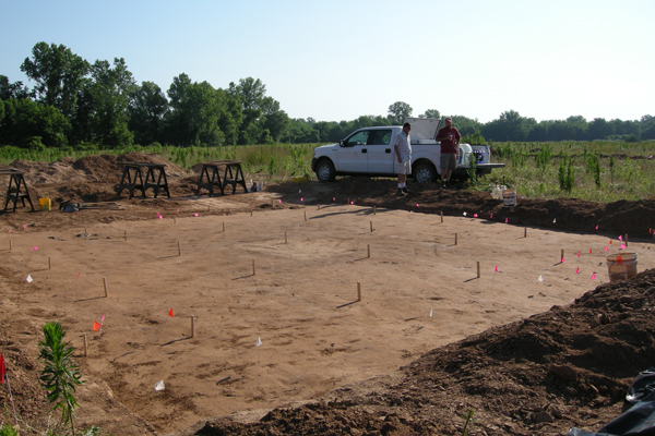
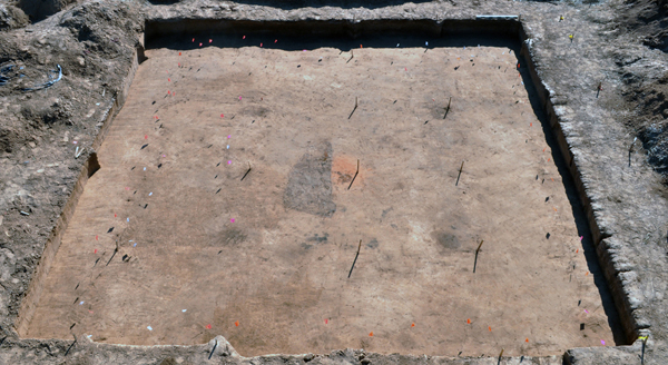
We identified dozens more post molds and a few shallow interior pit features, revealing the “footprint” of the house in its entirety. The house pattern was sufficiently large that we had to rent a boom lift to take proper photographs.
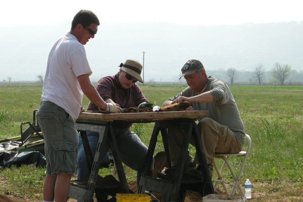
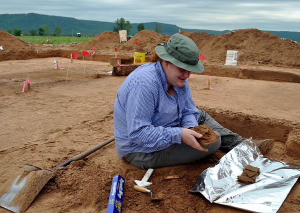
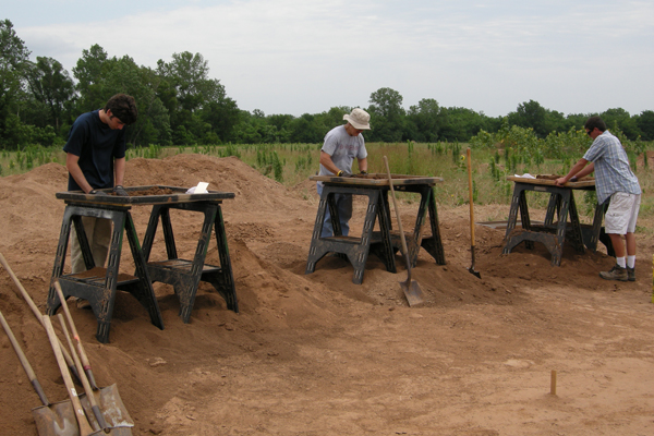
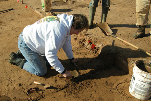
All pit features, the large central roof support posts, and a sample of the wall posts were cross-sectioned, with excavated sediments collected as flotation samples. We also collected oriented samples of baked sediments from the hearth area (Feature 11) for archaeomagnetic dating, although repeated plowing through the soft sediments covering these features may have displaced magnetic directionality enough to destroy the prospect for obtaining usable results.
Though our analysis of the excavation data is far from complete, several preliminary observations can be made. First, the house is nearly perfectly square, measuring just under 8 m on a side. The central hearth is surrounded by four equidistant roof support posts, each of which (before removal) was embedded to nearly the same depth (we measured the bottom depths of each post within 1 cm). Angled post molds to the south and west of the hearth area represent poles arched over the hearth, probably for hanging cooking vessels. A small number of additional interior post molds are likely associated with benches. The house entryway is oriented to the west and consists of two spaces or gaps on either side of a wall post located in the exact center of the west wall line. Just outside the west wall and aligned with the central wall post is another very large post hole feature, measuring a meter in diameter and penetrating to a depth of nearly three meters beneath the plow zone. A likely interpretation is that this large post supported an insignia of some sort – perhaps of a clan or some other social group associated with the house occupants. It is unlikely, on the other hand, that this post was actually embedded three meters or more into the original ground surface. Given the great weight we can estimate for a post of this size, and given the very fine and easily displaced character of the silty sediments across this site, we believe that the combined effects of downward sinking when the pole was emplaced and additional disturbance when it was removed produced the very deep feature that we observed. We also located another complex of intersecting trash pits, associated with this house, located just a few meters away to the south and west. We excavated about one-third of the estimated pit fill, retrieving an excellent sample of artifacts and faunal and carbonized floral remains. Larry Porter also found a blue wound glass trade bead.
At this point our excavations have retrieved sufficient evidence concerning the architectural features of House 1 to satisfy our current research needs. We may conduct additional excavations in the trash pit features to enlarge our sample of the associated material culture, pending an initial assessment of the artifacts and other remains presently in hand. April and May, 2011 We spent two more weeks in April, 2011, conducting excavations at another house feature revealed in the remote sensing imagery. House 3 is located about 35 m east of House 2; both appear to belong to a neighborhood of seven or eight houses distributed in two rows organized in an east-to-west orientation. We selected House 3 for excavation because Dr. Lockhart's evaluation of the remote sensing imagery suggested the possibility of an intact floor. The imagery indicates that this structure, like House 1, is square with four interior roof support posts surrounding a central hearth. Four possible pits features also appear to be located nearby, to the south and west of the house, and to the west and east there appear to be ravines possibly filled with trash.
The AAS field crew included George Sabo, Jami Lockhart, Jerry Hilliard, Michael Evans, Marion Haynes, Liz Horton, Aden Jenkins, Duncan McKinnon, Jared Pebworth, Larry Porter, and Leslie Walker. Arkansas Archeological Society volunteers included Don Higgins, Paul Knapp, Jim Rees, Dr. Susan Poznar, Alan Smith, and Bob and Judy Emerson. Trini Haddon, Trona Wells, Martin Miles, Kenneth Gilmore, Kat Avant joined us from the Osage Nation, along with Sonnie Clahchischiligi, a writer for the Osage News. Dr. Scott Hammerstedt and Dr. Amanda Regnier from the Oklahoma Archeological Survey also participated in the excavation, along with John Riggs from the Natural Resources Conservation Service.
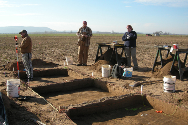
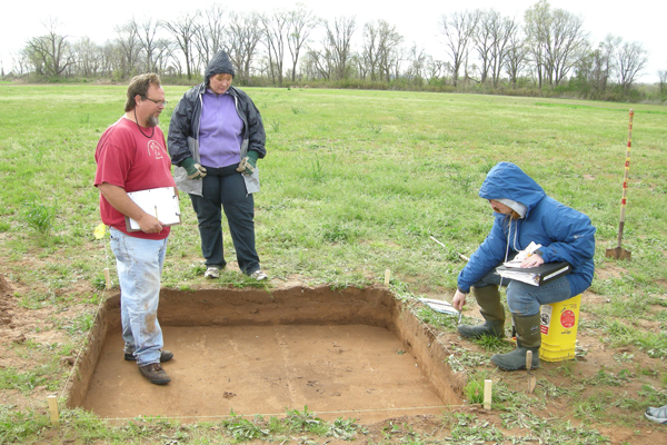
Following the practice employed in the other house excavations at the site, we began by opening up two 2 x 2 meter excavation units to intersect wall post corners and determine the depth below surface and stratigraphic context of those features. A third unit was opened up over a suspected hearth feature. As with our other two houses, we encountered those features at the base of the plow zone. The plow zone contained very few artifacts and no materials in an interpretable context.
Accordingly, we decided to strip most of the plow zone, which John Riggs kindly accomplished for us.
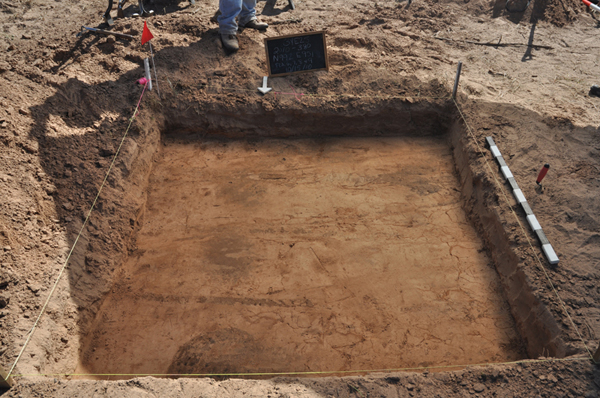
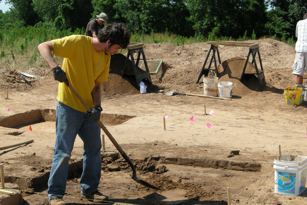
Our hand excavation of House 3 proceeded by shovel shaving the remaining plow zone sediments overlying the house, which revealed a nearly perfect square area, measuring approximately 8 meters on a side, of dark brown, densely compacted, clay-rich sediment.
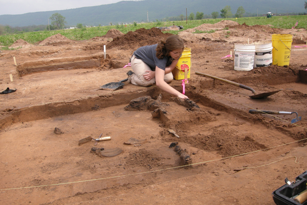
Excavation of this sediment in additional 2 x 2 meter units revealed that it was added to bury the house remains as those remains were burning, thereby creating an oxygen-deprived, reducing atmosphere that preserved several fallen wall posts and in situ post features in the form of charcoal. The central hearth feature, which had been partially disturbed by looters, also had a very hard, dark green surface – another indication of cooling under a reducing atmosphere.
The presence of the dark brown sediment burying the house remains suggests that the structure was purposefully destroyed by fire. As we removed more and more of the overlying sediments, we unearthed more facts about this residence.
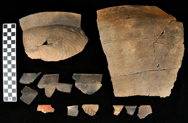
In addition to the scattered, fallen posts, we also found at the same level quite a few artifacts – mostly ceramic sherds (some quite large and many that can be refitted to reconstruct partial vessels) – along with a ceramic smoking pipe, an oddly perforated ceramic plummet, and a ground sandstone discoidal. Together these materials provide evidence of an intact floor level, though it appeared to us that the structure did not have a prepared, packed clay floor but rather just a dirt floor compacted by interior foot traffic.
Another finding is that the artifacts on the floor are distributed around the outer portion of the floor, just inside the wall posts. Additionally, the central part of the floor area, encompassing the hearth and interior roof support posts, is darker with a higher content of minute charcoal fragments than the outer floor area closer to the walls. This evidence suggests the possibility that a series of bench structures encircled the interior, extending out from the house walls, under which some artifacts remained when the structure was abandoned and set aflame. Finally, the absence of appreciable amounts of daub (we observed no more than occasional small bits of burned clay) indicates that the walls were covered with something other than clay plaster.
We have yet to complete an analysis of the artifacts found on the floor of the house, but some preliminary observations on the ceramics are interesting. Most of the ceramics are plain utilitarian wares, including very large storage vessels with rim diameters in the 50 cm range. The predominant type is Mississippi Plain, some with crenelated rim treatments. We also have examples of Keno Trailed jars, Carson Red on Buff jars or bowls, Barton Incised vessel rims, and rim fragments of Friendship Engraved and possible Hodges Engraved bowls. These are all types well represented in the museum collections of whole vessels looted from Carden Bottoms cemeteries.
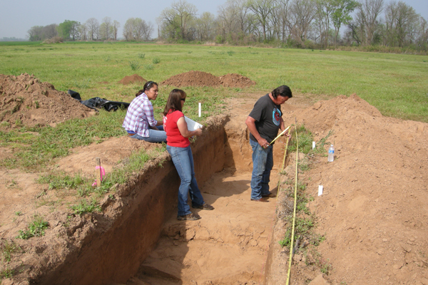
In addition to the House 3 excavation, we tested several other features revealed in the remote sensing imagery. To the north and east of the house, the imagery revealed a sinuous, linear feature interpreted as a ravine. Since we knew from excavations at adjacent 3YE347 that such features are sometimes filled with trash deposits, we excavated an intersecting trench to reveal a profile and collect artifact and sediment samples. Sure enough, we did find a natural ravine filled with midden deposits, though in this case containing only a modest amount of artifacts.
We also placed excavation units over two of four possible pit features located a short distance south and west of House 3. One of these features turned out to be a tree root stain. We identified the other as a pit feature but discontinued excavations when its plan view outline below the plow zone took on an elongated shape. We found no material evidence indicating the function of this feature, but since burial pits often take this shape and in view of our memorandum of understanding with our Caddo, Osage, and Quapaw collaborators, we stopped excavation and refilled the unit after we produced plan and profile drawings and photographs, and shot in horizontal and vertical control points from our mapping station.
During the last couple of days in the field, another 2 x 2 meter unit was opened up over a second suspected ravine feature located several meters to the southeast of House 3. Here we encountered a very dark midden deposit below the plow zone.
Dr. Jami Lockhart and Dr. Scott Hammerstedt also conducted additional remote sensing surveys to the east of the House 3 excavation area, moving in the direction of House 1, located at the eastern end of the site. They discovered interesting evidence of yet more structures, but arranged in a somewhat different pattern. We'll report the results of their findings as soon as they complete the processing and analysis of this latest imagery.
Intermittent rain during the second week of our excavations, intensifying into dangerous thunderstorms, prevented us from completing excavations in the second ravine unit and completing a final House 3 floor cleaning, though we succeeded in removing the charred timbers, which will be useful for radiocarbon dating.
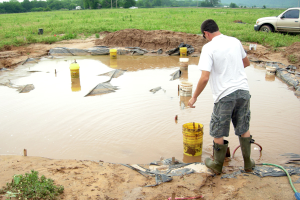
We returned to the site in late May to complete the House 3 excavations and to conduct additional high resolution remote sensing surveys. Intermittent but intense rains continued to hinder our efforts, sometimes filling our excavation units with so much water that we had to purchase a heavy duty pump to remove it all.
Despite this hindrance, we succeeded in tracing out the House 3 wall lines, as indicated by regularly spaced post molds, some still containing charcoal. Sabo collected samples of baked sediments from the hearth for archaeomagnetic dating, and we sectioned several post molds, which extended more than 50 cm below the floor level. Sectioning the four interior roof support posts revealed that they had been inserted to a depth reaching nearly a meter below the floor level, and--like those in House 1--each terminated at almost exactly the same depth. In sum, this house, too, had been well and carefully constructed according to a precise plan. Prior to destruction by fire, many of the heavier elements, including roof support posts and several wall posts, were salvaged presumably to be re-used at another location on the site. Our summary interpretation, based on field observations and pending full analysis of the evidence we collected, is that upon termination of occupation House 3 was cleaned of most of its contents, save for sundry items distributed mostly (but not exclusively) near the walls, possibly beneath interior platforms extending inward from the walls. The house was then set aflame, and while burning was pushed in and buried under several cm of sediments, creating a reducing atmosphere that preserved some structural elements as charcoal and produced the hard green surface on top of the hearth. Whether this was a ceremonial destruction or simply a practical procedure to contain the mess of a house needing replacement cannot now be determined. June and July, 2011 We returned to 3YE25 in late June for another two week period to re-open and continue the excavations in House 2, identified during our initial excavations in October, 2010. Our crew consisted of Mike Evans, Jerry Hilliard, Aden Jenkins, Jami Lockhart, Larry Porter, and George Sabo III, along with University of Arkansas graduate students Teka McGlothlin and Leslie Walker. We were also joined by David Halperin, a recent graduate of Haas Hall Academy in Fayetteville, who for the past two years has assisted us in the lab with analysis of Carden Bottoms vessels along with other materials from the Spiro Mounds. Having ascertained in October the stratigraphic context of buried features, our first step was to remove the plow zone via mechanical stripping and hand excavation.
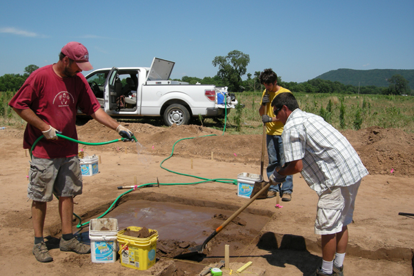
Next, we removed the backfill from the two units excavated last fall. The very hot and dry conditions at the site during this trip very quickly hardened the exposed sediments, making it difficult to excavate and identify post and pit features – opposite the situation we faced at the site during April and May, when we had to deal with excessive rain while excavating House 3. Our solution was to purchase a large water tank that could be fitted into the bed of one of our pickup trucks. The pump we purchased in April to remove water from open units can now also be used to spray water on dry units with a garden hose.
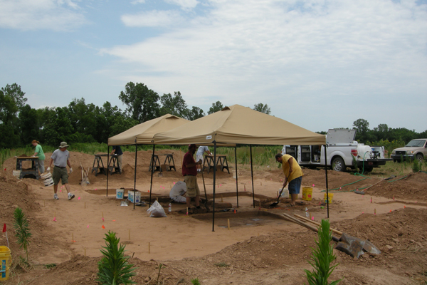
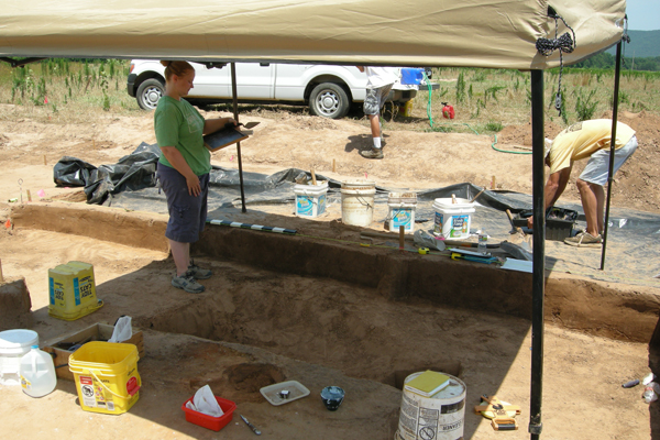
The use of sun shades over working units also helped to keep the sediments at a proper level of saturation. A series of rain showers during one day and one evening during the second week of this trip also provided significant relief for our efforts.
Excavations centered on a series of contiguous 2 x 2 meter units in the central portion of the house, expanding outward from one of the previously excavated units in which burned sediments associated with a hearth had been noted. We also expanded the other previously excavated unit where post molds associated with the northern wall had been identified.
Our excavations revealed a layer of sediments, approximately 20 cm thick, below the plow zone and above House 2 floor features. As with House 3, this layer of sediments had been intentionally added to bury the remains of the house as it was being demolished.
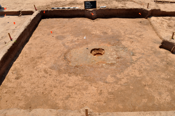
We identified several interior features beneath the overlying sediment mantle. Most conspicuous was a large hearth (Feature 175), with a hard, green glazed surface produced in a reducing atmosphere – once again the result of intentionally covering burning house remains with the mantle of overlying sediments. Also similar to House 3, this hearth was partially damaged by a central pot-hole excavated by looters. We were able to remove oriented samples of oxidized sediments beneath the green glazed layer in a portion of the hearth areas left undamaged by the pot-hole. These will be submitted for archaeomagnetic analysis to help determine the age of the house.
Other house features include central roof support posts and scattered interior post and small pit features. We also identified a series of post molds that define part of the north wall. Though we have yet to trace out the entire wall pattern and cross-section the post molds, it appears that this house is very similar to Houses 1 and 3 in terms of size, orientation, and architectural details. As with the other houses, it appears that here, too, many of the larger structural elements were salvaged before the remaining debris was set to flame and then buried.
Artifacts found so far include ceramic sherds similar to those retrieved from the other house and trash pit excavations along with a variety of stone tools. December, 2011 and January, 2012
Unusually hot and dry weather conditions during the summer of 2011 delayed completion of House 2 excavations until after the fall hunting season. We completed the House 2 excavations and documentation during two short excursions to the site, each lasting a week, in December, 2011 and January, 2012. The Survey crew consisted of Michael Evans, Marion Haynes (Blytheville Research Station), Jerry Hilliard, Aden Jenkins, Jared Pebworth, Devin Pettigrew, Larry Porter (WRI Research Station), Michelle Rathgaber (Blytheville Research Station), George Sabo, John Samuelsen, and Leslie Walker. We were joined by Kat Avant (Osage Nation); Arkansas Archeological Society volunteers Don Higgins, Dr. Susan Posner, Stephen and Owen Prater, Jim Rees, and Alan Smith; and U. S. Forest Service archeologists Dr. Mary Brennan and Robert Waldron.
Work in House 2 consisted of several tasks. First, we completed excavation to floor level of several units along and just inside the wall lines. We recorded the in situ locations of most of the artifacts we encountered, and all diagnostic items, via Total Station measurement. Upon completion of all units, we re-troweled the entire floor area and took a final series of photographs including aerial photographs from a lift boom. Then we collected a final set of Total Station measurements for all post molds and other features. Finally, we cross-sectioned the four interior house posts and a selection of wall posts for profile mapping and to collect preserved charcoal samples for radiocarbon dating and additional sediment samples for flotation.
Houses 2 and 3 at 3YE25 belong to a neighborhood of houses at the western end of the site that seem to be arranged in parallel rows with each house oriented to the cardinal directions, doorways (where they are evident) opening to the east or west. Both of these houses are similar in architectural details to House 1 farther east. Separating the House 2 and 3 area from the House 1 area is another neighborhood consisting of several houses arranged around what appears in the gradiometry maps as an open area (perhaps an small plaza?); some of these houses are also oriented to intercardinal directions. Our plans for completing the current work at 3YE25 include the excavation of one to two houses in this latter neighborhood, during Fall, 2012. Stay tuned.
|
||||||||||||||||||||||||||||||||||||||||||||||||||||||||||||||||||||||||||||||||||||||||||||||||
 |

|
