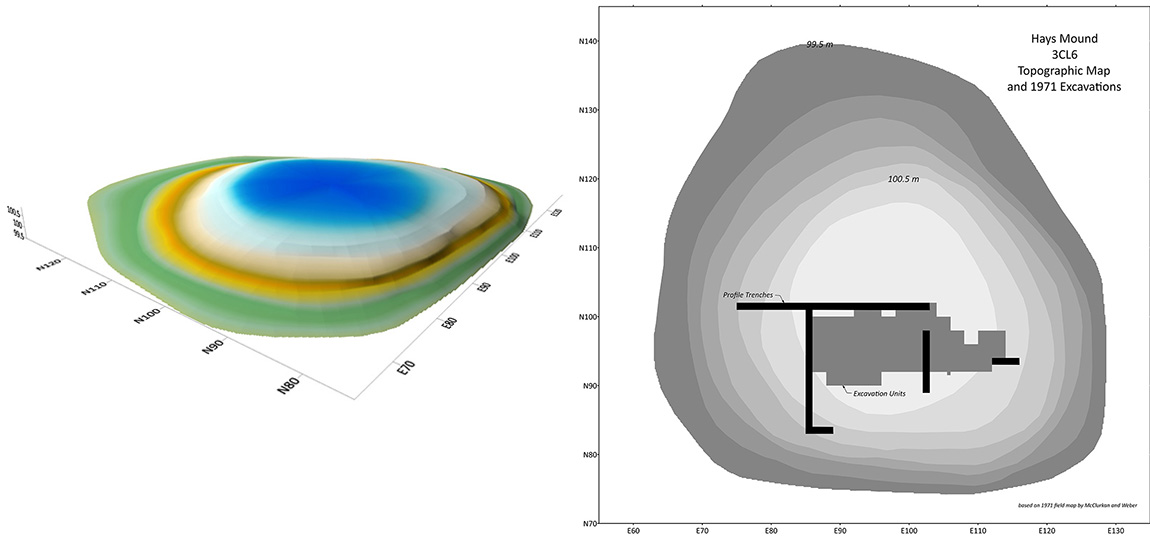
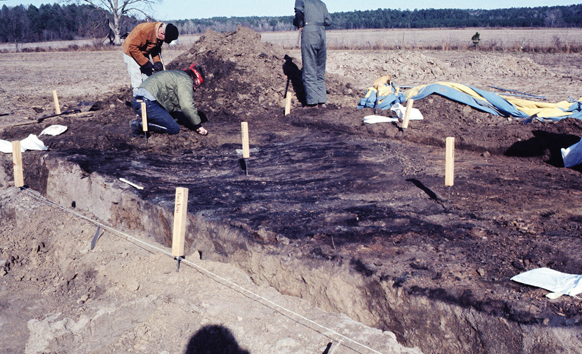
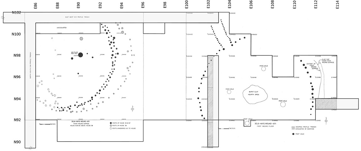
The buildings buried in the east side of Hays Mound had wall posts in circular patterns measuring 8 m and 10.7 m (26´and 35´) in diameter, with four larger interior posts set around central hearths. While separated by 60 cm (2´) of fill, the hearths and central posts of the Zero Mound and First Mound structures were nearly in the same locations. The First Mound structure was larger and had an extended entryway to the northwest. These structures had been burned and the walls collapsed inward, then covered with earth. On the west side of Hays Mound, three partial circular post patterns (10–14 m or 33–46´ in diameter, Third Mound House 3A, 3A’, and 3B) overlapped one another, with ash deposits and a central hearth/ash-filled post pit.
While the structures on the east side had been cleaned out before they were burned, the west side structures had abundant pottery sherds, stone tools, animal bone and mussel shells, and charred nutshell and seeds. To Cynthia Weber, the different treatments at the closure of the buildings indicated different functions; she concluded that the ancestral Caddo leaders’ residences stood on the lower western platform while public or ritual structures were placed on the higher platform on the east.
After fieldwork concluded, Weber completed the analyses and wrote a report. Unfortunately, it was not published or widely disseminated at that time. However, the Arkansas Archeological Survey has curated the artifacts, photographs, and records, ensuring that the project can be looked at again to generate new data and interpretations.
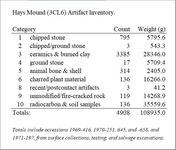
In 2018 and 2019, Ann Early (then Arkansas’s State Archeologist) re-inventoried and reanalyzed the Hays Mound artifacts. In 2023, Aswa Khan and Mary Beth Trubitt (the Arkansas Archeological Survey’s Henderson State University research station archeologist) input the field records and artifact inventory into the Survey’s customized FileMaker Pro program. A total of 4,908 artifacts and samples from Hays Mound have been entered and linked to the state’s Automated Management of Archeological Site Data in Arkansas (AMASDA) database.
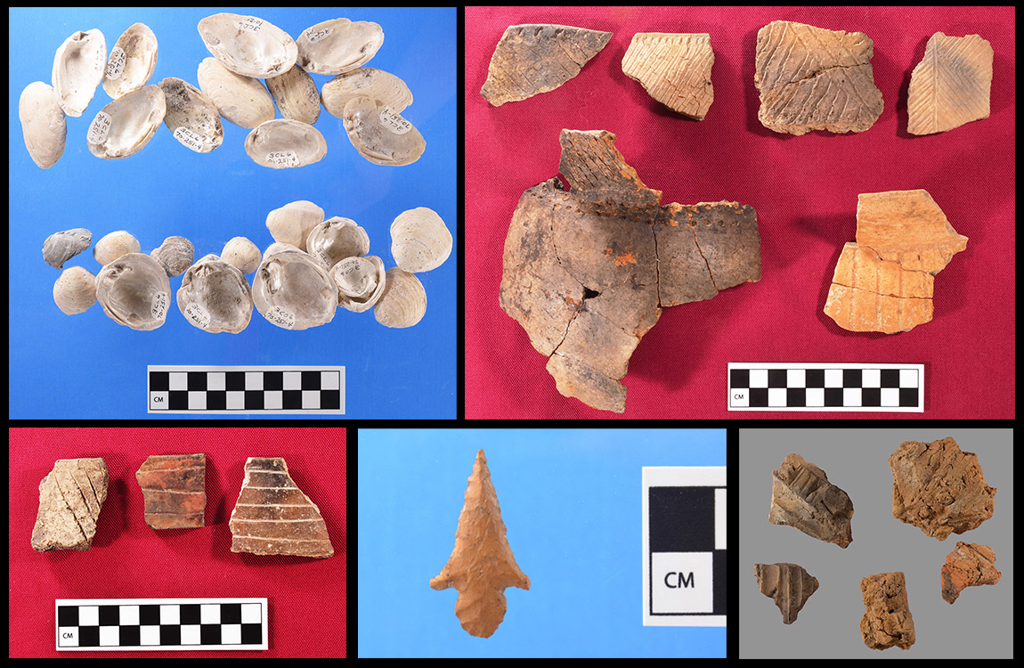
Stone tools chipped from novaculite and chert, along with pieces of chipping debris from tool manufacture and resharpening, are present at Hays Mound. A Hayes type arrow point was found on the Second Mound Surface; this style (not named from this site) is characteristic of Early Caddo period sites across the Caddo area.
Cynthia Weber obtained 13 radiocarbon dates from charred wood and cane from Hays Mound excavations. The dates ranged from AD 1000 to the 1450s, with overlapping results for the Zero, First, and Second Mound surfaces. Weber also sent samples of charred plant material from the excavations to the Missouri Botanical Garden in St. Louis, where Hugh Cutler and Leonard Blake identified domesticated corn as well as hickory, black walnut, acorn, pecan, and persimmon as food resources.
Hays Mound was a key context for Ann Early’s definition of the Early to Middle Caddo period East phase (ca. AD 1100–1350).
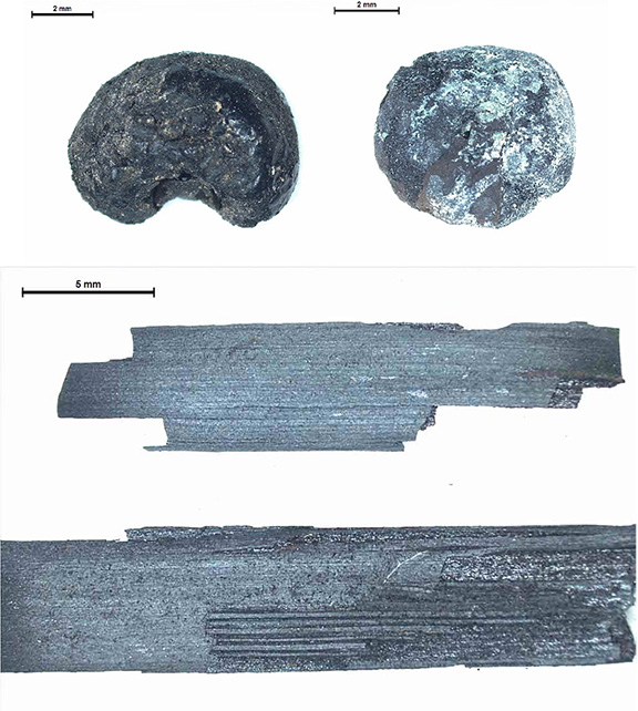
In 2024, Mary Beth Trubitt selected and sent six charred botanical samples from Zero, First, Second, and Third Mound Surface contexts to archeobotanist Leslie Bush (Macrobotanical Analysis). She identified specimens and recommended samples for radiocarbon dating. In addition to corn (Zea mays kernels) and grass thatch (Poaceae culms), she also identified seeds (erect knotweed, persimmon, plum/cherry, grape, sumac, and morning glory) and nutshell (hickory, black walnut, and acorn) that may have been from food used by ancestral Caddo people at Hays Mound.
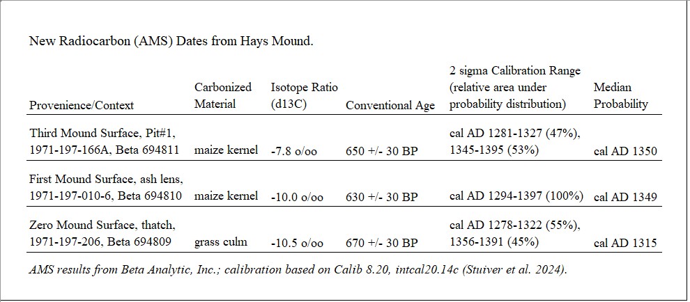
Using the accelerator mass spectrometry (AMS) technique for radiocarbon dating, very small samples of charred plants can now be dated. Trubitt sent three samples—grass thatch from the Zero Mound structure and corn from outside the First Mound structure and from Third Mound House 3B—to Beta Analytic, Inc. Calibration of the conventional ages shows overlapping ranges in the late 1200s to late 1300s, with median probabilities between cal. AD 1315 and 1350.