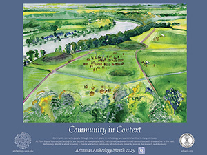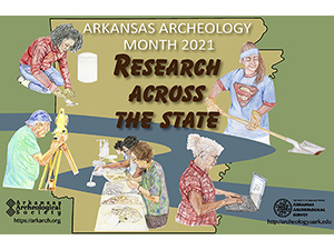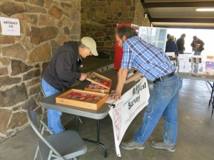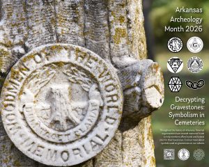
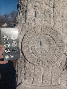
Every March, we celebrate Archeology Month in Arkansas! It looks a little bit different every year, but we always create a poster (Figure 1) and host events all over the state to Celebrate Archeology! This year we have over 50 events on the calendar in March for you to get involved or learn more about the archeology and history of our state. On the calendar, events are named with a code indicating in which part of the state they are taking place (i.e. NE=Northeast, C=Central, etc). We’ve got events going on in every corner, so we hope that you are able to join us for at least one program during March. We have cool bookmarks/photo scales based on this year’s poster (Figure 2) to hand out!
This year’s poster was once again designed by our Graphic Artist, Rachel Tebbetts. We wanted to focus on historic archeology this year, and what better way than to focus on cemeteries? Cemeteries are everywhere and most of them are publicly accessible. Anyone can walk around most old cemeteries and look at the headstones. This can help us to better understand the history of an area by seeing when people were born and died, how large families were, if children died early or lived into adulthood, and sometimes some interesting facts about someone’s life that their family had inscribed on the stone. Sometimes the stones themselves can tell us about life in the region through imagery and symbolism. Fraternal organizations existed throughout Arkansas and the United States (and still do, to some extent) to help people with the burial of their loved ones after death when many families were not able to afford a full funeral and grave marker.
Some examples of fraternal organizations are the Elks, the Masons, Independent Order of Odd Fellows, Knights and Daughters of Tabor, Mosaic Templars of America, and International Order of Woodmen of the World, many of which have sister organizations. Benevolent societies traditionally had burial plots set aside so that “fraternal feelings could continue unbroken into eternity” (Brown, 1994, p.9). Prior to the existence of formal health and life insurance, “benevolent societies were formed to provide their members with companionship, medical care, and death care. Immigrant groups originated many of these societies as a way to preserve and honor the ways of the old country. Conversely, people who wanted to distance themselves from the new arrivals formed their own organizations” (Keister, 2008, p. 187). These clubs had their greatest popularity among both European Americans and African Americans during years of heavy immigration and the years following the Civil War in the southern United States. Enrollment in such organizations began to significantly decline “in the 1930s after the enactment of the New Deal, which provided a number of the same benefits as the benevolent societies did” (Keister, 2008, p. 187).
Each of these societies has symbols associated with it that appear on headstones, sometimes with slight variations at different times. We chose common symbols of each of these societies to feature on this year’s Archeology Month poster. They are depicted in circles on the right side of the poster. Top left: Mosaic Templars of America, Top right: Freemasons, Middle left: Supreme Royal Circle of Friends of the World, Middle right: Woodmen of the World, Bottom left: International Order of Twelve, Knights and Daughters of Tabor, Bottom right: Independent Order of the Odd Fellows
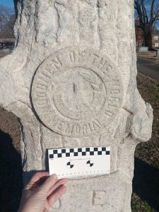
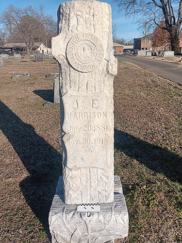
The main poster image is a Woodmen of the World headstone from a cemetery in Fayetteville (you can learn more about that specific monument in our March Artifact of the Month article). There is a lot of public interest in historic cemeteries across Arkansas, and we often get questions and information from concerned citizens about recording and cleaning up historic rural cemeteries. When people began leaving rural areas in the early 1900s, family and local cemeteries were abandoned. With growing interest in genealogical research in the early 2000s, many people have realized that they may have family members buried in cemeteries in Arkansas and want to make sure that the cemeteries are cared for.