Carl Drexler, SAU-Magnolia Research Station
"Archeology is..." series - July 2025
We often tell people that an artifact’s context is at least as important as the artifact itself. The context is the place where it was found and the other things around it. Where was the artifact on the landscape (was it on top of a hill or next to a river)? Where was it in the soil (right at the surface or deeply buried in clay)? What else was there (were there thousands of other artifacts or was it an isolated find)? This context tells us about the past in ways that the artifact alone simply cannot.
Archeologists must document that context very carefully. Doing so allows us to understand and preserve it and then tell the world about what we learned from both context and artifact. We document using field notes, photographs, and maps. Of these, we are talking about maps today. Maps help us understand sites, communicate what we learn, and to plan further research.
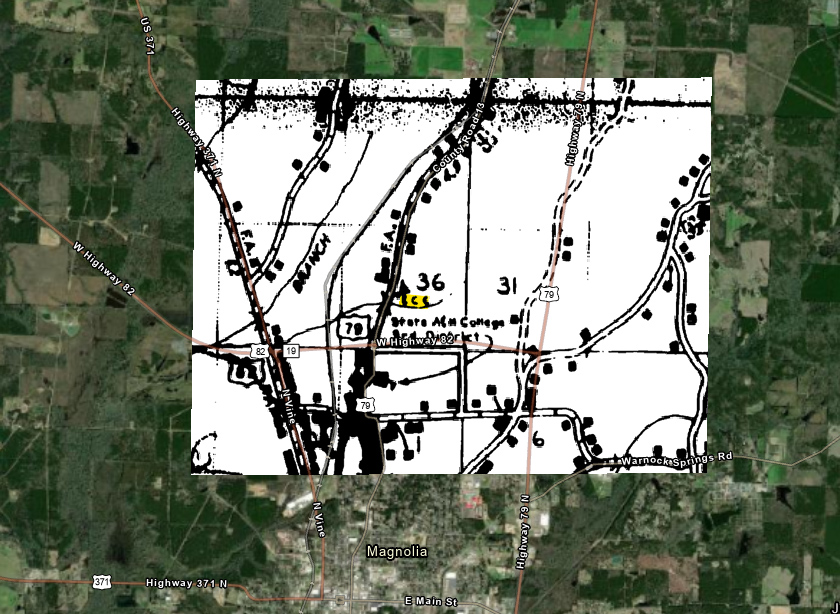
Archeologists started making maps at the very start of the profession. Some of the books written in the late 1800s and very early 1900s have beautiful hand-drawn maps of the sites they focus on that are of immense value in telling people about the sites of the past. We still make maps today, using some of the same approaches, but the tools we use have changed drastically (Figure 1). Today, one of the most important tools we use for map making is called geographic information systems, or GIS.
GIS consists of computer software that is used to store, display, or analyze geographic information. If you have a smartphone, you have a GIS in your pocket in the form of a mapping app. I admit that this is a core focus of mine, so it should not be that surprising that I have 21 apps on my phone that are primarily GIS programs (though in counting just now I was a little surprised it was that high). Other apps use GIS as part of their functionality, like restaurant chains that use your location to determine which is the nearest to you so you can pick up your food quickly instead of having to drive to Nashville, Tennessee, to get your dinner instead of Nashville, Arkansas (no, I never made that mistake… but I’d consider the trip for a really good vindaloo and a Predators game).
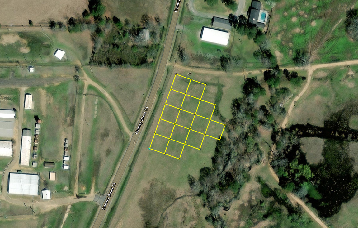
In archeology, we use GIS literally every day. We plan excavation projects using GIS, laying out planned units on the computer before we ever go into the field Figure 2). We also use GIS to overlay aerial photographs, LiDAR (laser-based microtopography) data, and other kinds of supporting information that helps us understand sites and their surrounding landscapes. Once we are in the field, we collect geographic information with hand-mapping, surveyor’s total stations, and other equipment, all of which we bring back and drop into our GIS software for keeping records and also analysis.
Some projects use only GIS to produce important results. Specialists use data from across wide areas to show the distribution of certain artifact types, or to show connections between certain landforms and sites of a certain era. We can take a given point on the landscape and use a 3D database to map out what part of a landscape someone could see from a chosen place, which can tell us about how people decided where to live, what resources they were focused on, and how they moved about the landscape. We even have algorithms that estimate how much energy it would take to move between two places and plot a route that would be easiest, which might tell us about old road alignments. There is so much we can do with GIS from a computer laboratory.
We also keep our statewide site records in a database, called AMASDA, that can be searched geographically. We know where sites are, and where archeologists have done research over the years, and can display that information through a very helpful geographic interface. So, from start to finish, planning to record keeping, we use GIS throughout archeology.
I will close by noting that, like many other industries around the world, archeology is definitely not going to become less focused on GIS in the coming years. As software becomes more common and people become more accustomed to using the tools available to us, GIS is going to become more and more important to doing archeological fieldwork. As the kinds of data archeology has available to it expands, someone will figure out how to deal with them geographically, which will just continually expand the reach of GIS.