
Jami J. Lockhart and Timothy Mulvihill, Arkansas Archeological Survey
Feature of the Month - April 2022
Richards Bridge (3CT11) is a late Mississippi period, Parkin phase archeological site first recorded in the 1940s by Phillips, Ford, and Griffin, but never fully investigated. Beginning in late 2013, Survey personnel, with help from Arkansas Archeological Society members, began a program of mapping and exploratory geophysical surveys. Results indicate numerous interpreted archeological features, including more than 60 pre-contact/protohistoric structures. The 2.7 hectares of gradiometry collected thus far provide insights into feature type, location, size, shape, preservation, orientation, spacing, and alignment, as well as estimates of population size, density, and other elements of intrasite organization (Figure 1, top left).
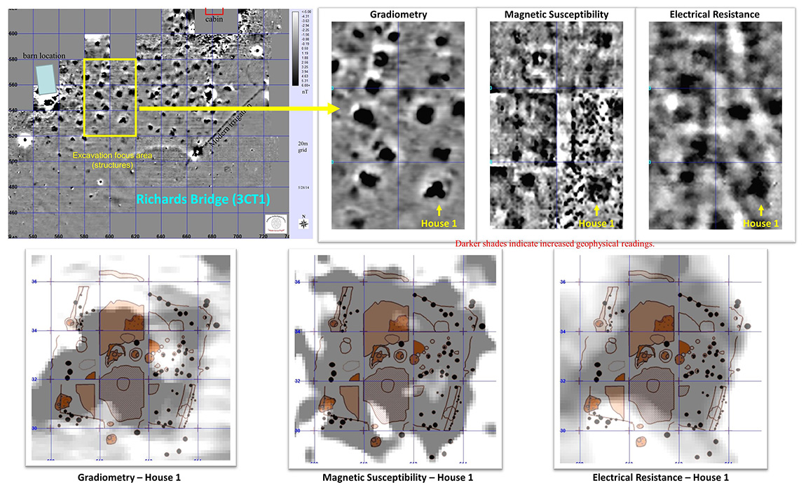
Prior to excavations, we collected multisensor geophysical data for part of the larger area. The yellow rectangle in Figure 1 outlines six 20x20m grids that we also surveyed with ground penetrating radar, electromagnetic conductivity, magnetic susceptibility, and electrical resistance. That 40 x 60m area contains at least 12 structures – four of which were selected for full excavation during consecutive Arkansas Archeological Society summer training programs. The bottom three images in Figure 1 compare the geophysical signatures for three technologies that guided the excavation of House 1, along with subsequent mapping superimposed on each.
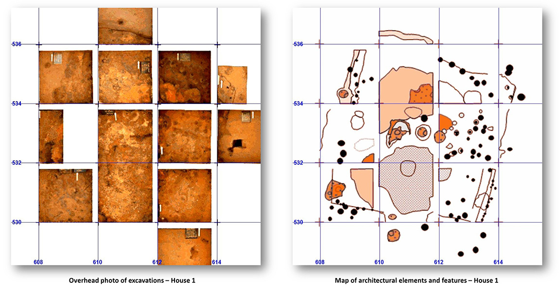
Figure 2 (left) shows a mosaic of photographs taken from above each 2x2m test unit during the excavation of House 1, and a map of interpreted archeological elements comprising the house (right). Those elements included wall lines and trenches, the structure floor, burned wall and interior posts, a central hearth, storage pits, and large areas of burned clay that originally daubed the walls and roof smoke hole. Precision surveying, geophysical remote sensing, image processing, interpretation, targeted excavation, detailed feature mapping, and artifact analyses – each play a role in discoveries at House 1.
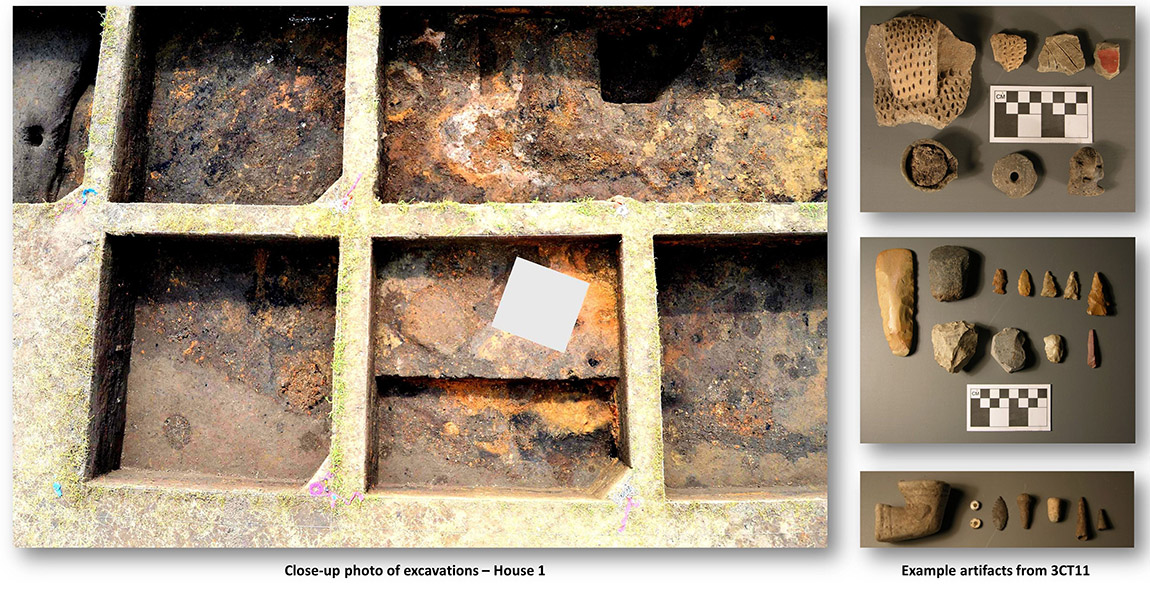
Ongoing research at scales ranging from the broader cultural landscape down to individual artifacts (Figure 3, at right) continue to refine our interpretations of lifeways on the frontier between pre-contact and post-contact history in northeast Arkansas.
Feature of the Month Series
Archeological features are elements or structures that are nonportable or cannot be easily removed from a site (such as a wall or a post hole). Archeologists document archeological features extensively in the field to record what will otherwise be destroyed in the process of excavation. The records of these features are often all that is left at the end of an excavation. Excellent record keeping is necessary for these features to provide insight into the archeological record and site formation.
In this series, we present interesting and important archeological features that have helped archeologists to better or more fully understand the sites on which they were working. New features will be added monthly. Find the list of features here.