Mary Beth D. Trubitt, Ph.D. (ARAS-HSU Research Station)
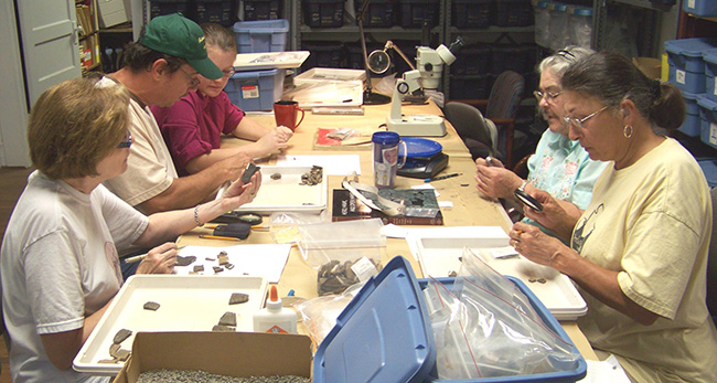
At the Arkansas Archeological Survey’s HSU Research Station, we have been comparing artifacts excavated from two Caddo mound sites. The sites – 3HS60 or Hedges and 3SA11 or Hughes – were contemporaneous communities located in adjacent river drainages in southwest Arkansas. Next to each site’s main mound, excavators uncovered traces of a series of burned buildings. These near-mound structures were probably linked to activities on the mounds. However, these structures were not treated in the same ritual fashion as were the buildings buried within the mounds. Instead of being burned and covered with “clean” earth, these near-mound structures had been burned and covered with soil containing lots of ceramic sherds, chipped stone tools and debris, animal bone, and charred plant remains. With the assistance of volunteers during weekly Archeology Lab Days at the Survey’s HSU Research Station in Arkadelphia, we analyzed artifacts from Hedges as a comparison with the Hughes material.
.")
In the early 1970s, Ann Early led test excavations at the Hedges site, 3HS60, located in the Ouachita River valley in Hot Spring County. Fieldwork included mapping two low mounds at the site, auger testing to document the depth and extent of midden deposits, and hand excavation of several test units near the larger Mound A. While no complete structures were exposed, the excavators uncovered stratified deposits with burned cane and thatch, ash, daub, and postmolds. Artifacts indicated the site was used by ancestral Caddo Indians during the Mid-Ouachita (AD 1400–1500) and Social Hill (AD 1500–1650) phases of the Late Caddo period. Dan Wolfman calculated an archaeomagnetic date on a burned structure floor from the site at AD 1450–1535. More recently, charred maize kernels from the site were directly dated using the accelerator mass spectrometry technique to cal. AD 1650–1660 (1-sigma range).
The Hughes site, 3SA11, is located in the Saline River valley in Saline County, at the eastern edge of the Caddo archeological area. I conducted excavations here as part of the 2002 Henderson State University/University of Arkansas archeological field school. Part of my motivation was concern about people digging into the main mound at the site; in addition to creating a topographic map of the two-stage mound, we filled in several large potholes. After systematic shovel testing across the site, we excavated several 2x2 m units to investigate architectural features. Near the main mound, crews uncovered a stratified deposit with burned timbers, burned earth and daub, and quantities of ceramic sherds, chipped stone debris, and animal bone. The artifacts recovered from excavations show similarities to those characteristic of the Social Hill phase in the Ouachita River valley. Three charred wood samples were radiocarbon dated, with resulting 1-sigma ranges of cal. AD 1270–1300; 1290–1320 and 1340–1390; and 1450–1510 and 1600–1620.
Our artifact analyses have had two goals: to place the use of these Caddo communities in a temporal and cultural framework; and to gain a better understanding of activity patterns in near-mound areas of these sites. Arrow points were examined to identify types that have been used as “time markers” elsewhere. In addition, the chipped stone artifacts at these sites can be used to discuss the acquisition, transport, and use of novaculite and other toolstones by the Caddo Indians in this region.
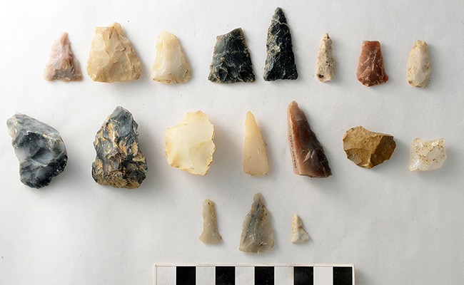
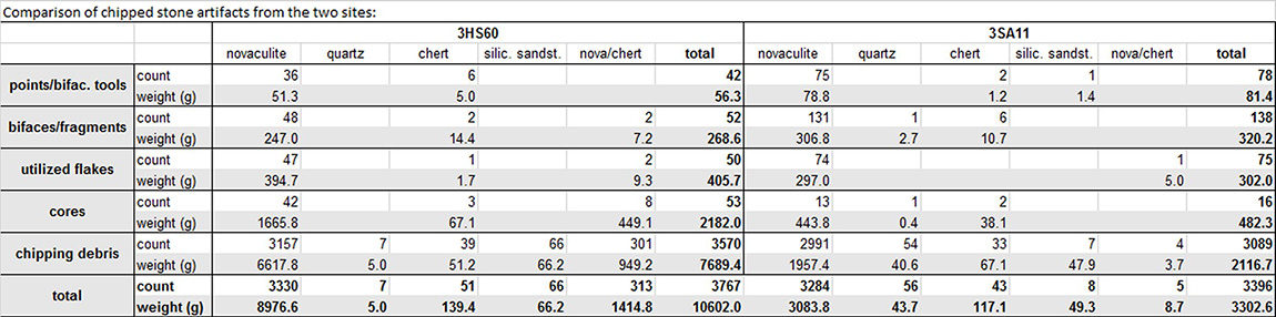
The chipped stone artifacts from 3HS60 and 3SA11 were analyzed in a comparable manner. Worked pieces (arrow points, bifaces and fragments, and retouched, utilized, or modified [RUM] flakes) were separated from manufacturing debris (cores/remnants and tested cobbles, flakes, and angular debris or shatter). Over 3000 chipped stone artifacts were examined from each of the two sites, but the total weight from Hedges was over three times the assemblage from Hughes (see table).
Novaculite was the predominant toolstone at both sites, representing 88% of artifacts at 3HS60 and 97% of artifacts at 3SA11 by count. Other raw materials included chert, quartz crystal, black novaculite or chert, and silicified sandstone. The opaque black stone in the “nova/chert” category could either be black novaculite or chert. Here, it is likely to be the novaculite that outcrops on mountain ridges around Lake Catherine rather than the Big Fork chert from sources further west in Arkansas’s Ouachita Mountains. While we were examining debitage in the lab, it became clear that there was a preference for dark-colored stone at 3HS60, reflecting the local raw materials available. There were also noticeably more novaculite tools and debris with cortex at that site. While we did not systematically record the kind of cortex, cobble cortex was frequently seen at both sites, indicating that residents used nearby river gravels in addition to outcrop quarries for raw material.

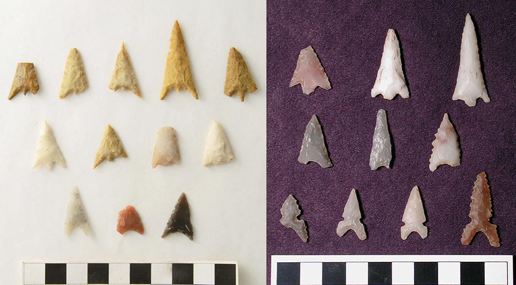
Projectile points and point fragments chipped from novaculite, chert, and silicified sandstone were recovered from both 3HS60 and 3SA11 excavations (3HS60, n=36; 3SA11, n=73). Many of these can be typed as Bassett and Maud arrow points, characteristic of Late Caddo period archeological sites in this region.