Jami J. Lockhart and Timothy S. Mulvihill
Feature of the Month - August 2023

""
Figure 1. Neeley’s Ferry and Parkin Phase vicinity.
An archeological feature can be defined as an individual element of a site. This Feature of the Month article describes in-progress research that combines multiple individual features to examine a complete archaeological site. Here we begin to analyze the meaningful ways these Late Mississippi Period people arranged themselves on the landscape just prior to and perhaps during the first European incursion into northeastern Arkansas in AD 1541.
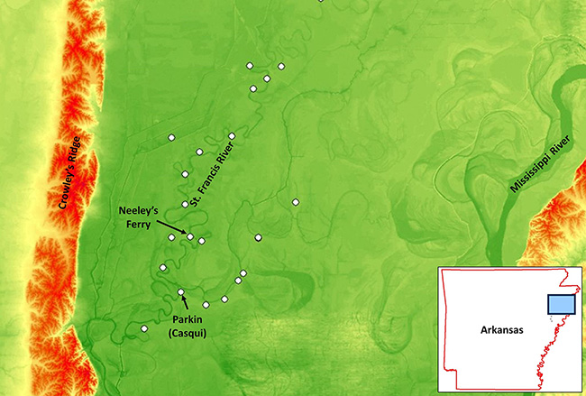
This work focuses on the Neeley’s Ferry site (3CS24), populated by people archaeologists recognize as belonging to the Parkin Phase, so named for cultural similarity to the Parkin (Casqui) Chiefdom visited by Spanish explorer Hernando de Soto. These sites were purposefully arranged along the St. Francis and Tyronza Rivers (Figure1). Neeley’s Ferry was first recorded by Edwin Curtiss in 1879 as part of his work for the Peabody Museum of Harvard University (Mainfort and Demb 2001). C.B. Moore also conducted work at 3CS24 while investigating mound sites along the St. Francis River in 1909–1910 using a steamboat as transportation (Moore 1910).  Limited archeological excavations followed (Phillips, Ford, and Griffin 1951; Morse 1981: Mulvihill, K. 1996). The more recent use of geophysical remote sensing allows archaeologists to examine archeological site organization at larger scales compared with earlier research models necessarily based on comparatively few and small excavations alone. The site is now owned by the Archaeological Conservancy which is partnering in this research.
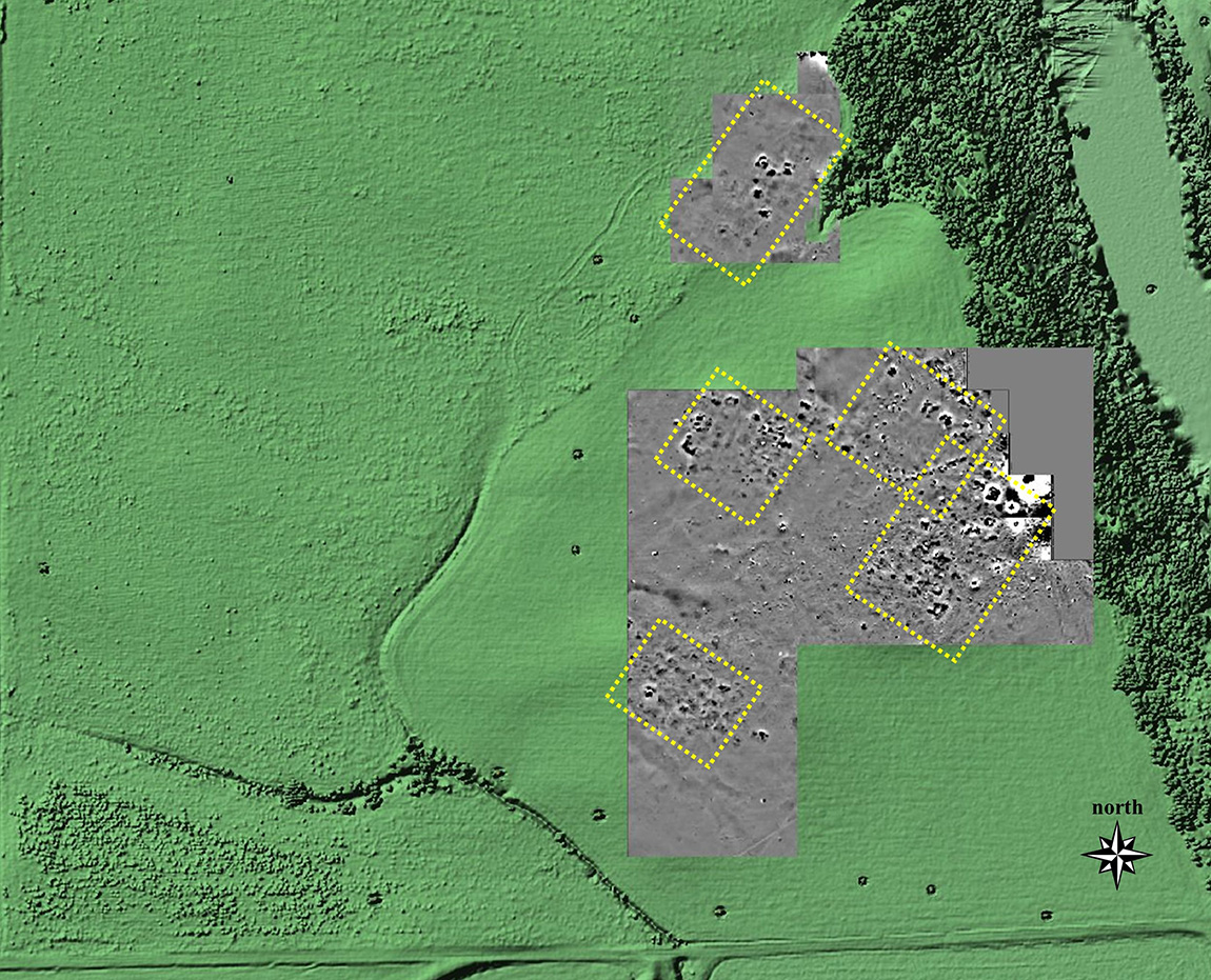
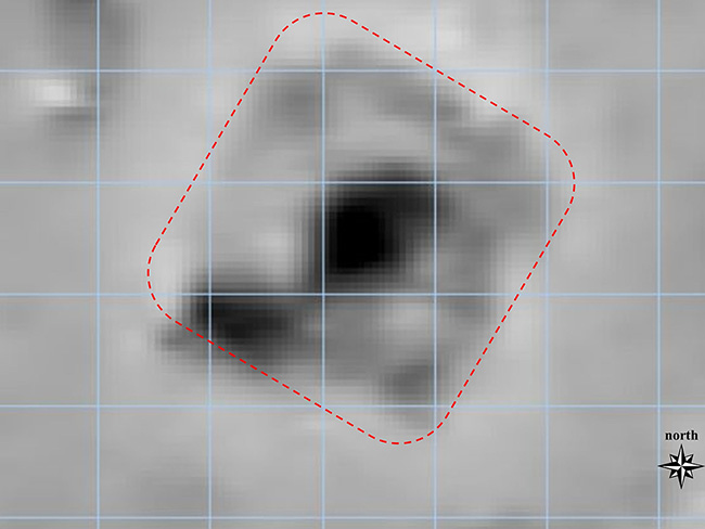
This brief article describes and depicts interpretations of site organization at a site-wide scale comprising numerous structures within a pre-European contact town.  The data were collected using fluxgate gradiometers that detect anthropogenic thermoremanence (burning) and other changes to the natural alignment and strength of magnetism in soils brought about by day-to-day living activities in the past (Kvamme 2006).  So, although long-buried archeological features are no longer visible on the surface of the ground today, they still have a measurable magnetic “footprint” below ground.
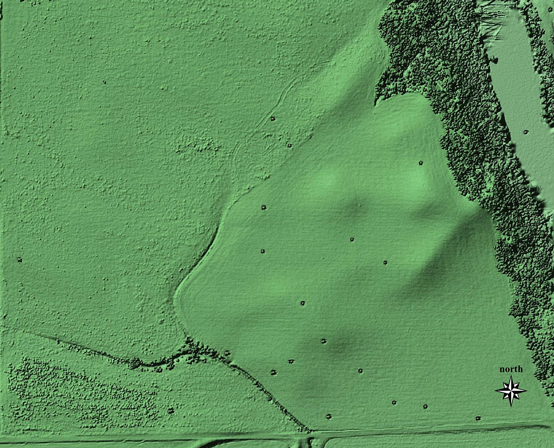
Figure 2 shows the current ground surface at Neeley’s Ferry as imaged using LiDAR technology. LiDAR data are commonly collected from the air by detecting the exact travel-time of millions of pulses of infrared light, and provide accurate elevations that can be processed for topographic representation. The small “hills” that are shown in Figure 2 are actually the remains of intentionally built civic-ceremonial mounds. The mounds have been greatly altered by modern agriculture, but are still visible today—even at ground level.
""
Figure 2. LiDAR topography, Neeley’s Ferry (3CS24). Data Source: USGS
Beginning in 2021, Mulvihill and Lockhart began systematically collecting gradiometry data covering approximately half of the approximately 6 hectare site. Figure 3 shows the results of the geophysical surveys to date.  Distinct rectangular compounds located within mounds are outlined in yellow.  Each of those compounds is composed of multiple buried structure remains that are aligned in a unique site organization that has never been seen before in Mississippian archeology in Arkansas. This uniform alignment of structures (approximately 40 degrees northeast) within distinct rectangular compounds obviously held important meaning for the people that populated the town as early as 600 years ago. As we continue to collect multisensor geophysical data for complete site-wide coverage, we are exploring the possibility of a sacred geometry guided by celestial alignment or some other rationale.
""
Figure 3. Gradiometry highlighting unique site pattern and orientation.
""
Figure 4. Gradiometry, interpreted structure and 2-meter grid (prominent central hearth and wall lines). Darker shades indicate increased magnetic signature.
Other interpretative elements that can be inferred from the data will detail site size and organization, site density, individual structure sizes, feature preservation, and implied hierarchy.  Because the geophysical data are georeferenced using accurate global positioning within a geographical information system, future archeological excavations may be pinpointed to uncover and examine specific feature types. Figure 4 shows a close-up for one of the Neeley’s Ferry gradiometer anomalies that is consistent with house signatures that have been fully excavated at nearby sites. The 2-meter grid shows the size and location of potential excavation units that could completely reveal this 6 x 6 m structure for detailed analysis.  There are many other potential candidates for future study, and Figure 4 is just an example of one structure for which we can clearly see the central (heavily burned) hearth and wall lines (outlined in red).
There is much yet to be discovered at Neeley’s Ferry. This article highlights some ways individual archeological features discovered using remote sensing can be combined to allow previously unattainable interpretations in terms of scale and scope. The geophysical work at Neeley’s Ferry is providing a basis for informed interpretation of a complex lifeway in which generations of people planned a distinctive settlement pattern, lived meaningful lives, and left behind a fascinating, discoverable legacy within the St. Francis River valley of northeast Arkansas half a millennium ago.

References

Kvamme Kenneth L.
2006 Magnetometry: Nature’s Gift to Archaeology. In Remote sensing in Archaeology: An Explicitly North American Perspective, edited by J. Johnson, pp. 205-233. University of Alabama Press.
Mainfort, Robert and Sarah Demb
2001 Edwin Curtiss’ Archaeological Explorations Along the St. Francis River, Northeast Arkansas, 1879-1880. The Arkansas Archeologist 41:1-28.
Moore, Clarence B. 1910. Antiquities of the St. Francis, White, and Black Rivers, Arkansas. Journal of the Academy of Natural Sciences of Philadelphia 14:253-364
Morse, Phyllis
1981 Parkin. Arkansas Archeological Survey Research Series No. 13. Fayetteville.
Mulvihill, Kelly
1996 Neeley’s Ferry: Investigations into a Mississippian Fortified Village Site. Paper presented at the 53rd Annual Meeting of the Southeastern Archeological Conference, Birmingham, Alabama.
Phillips, Philip, James A. Ford, and James B. Griffin
1951  Archaeological Survey in the Lower Mississippi Alluvial Valley, 1940 – 1947. Harvard University, Papers of the Peabody Museum of Archaeology and Ethnology 25. Cambridge.

Feature of the Month Series

Archeological features are elements or structures that are nonportable or cannot be easily removed from a site (such as a wall or a post hole). Archeologists document archeological features extensively in the field to record what will otherwise be destroyed in the process of excavation. The records of these features are often all that is left at the end of an excavation. Excellent record keeping is necessary for these features to provide insight into the archeological record and site formation.
In this series, we present interesting and important archeological features that have helped archeologists to better or more fully understand the sites on which they were working. New features will be added monthly. Find the list of features here.