![""](https://archeology.uark.edu/wp-content/uploads/2015/08/DC_visittocemetery-1.jpg)
Helms Cemetery
Mary Beth Trubitt, Ph.D., Arkansas Archeological Survey (HSU Research Station)
The Arkansas Archeological Survey has worked with community groups and individuals interested in preserving historic cemeteries across Arkansas. In 2010, the Buffaloes’ Foundation, Inc., obtained a grant from the Arkansas Humanities Council to document and preserve the Helms Cemetery in Clark County, Arkansas. The Helms Cemetery is significant as the burial place of several African-American men and women who were once prominent in education and medicine in Arkadelphia. As station archeologist at the Survey’s HSU Research Station, Dr. Trubitt served as a humanities scholar and assisted the Buffaloes’ Foundation with their project. One aspect of the project was mapping and photo-documenting grave markers in the cemetery.
![""](https://archeology.uark.edu/wp-content/uploads/2015/08/DHC_documentinggraves-1.jpg)
Dr. Trubitt recorded Helms Cemetery as archeological site 3CL873 following a 2009 visit with Mr. Leroy Brownlee and Mr. Art Tippin of the Buffaloes’ Foundation, Inc.
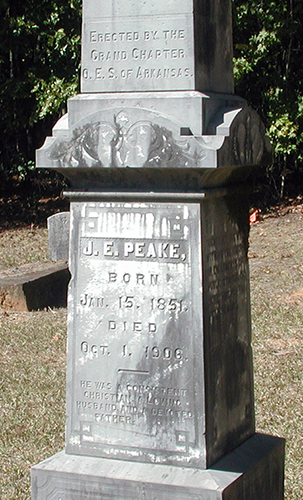
J.E. Peake (born 1851, died 1906) was superintendent at Bethel Institute, now Shorter College in North Little Rock. Peake High School in Arkadelphia, a Rosenwald school built 1928-1929 that is now used by Peake Elementary School, was named after him.
![Click or tap image for a larger view](https://archeology.uark.edu/wp-content/uploads/2015/08/DHC_3CL873mapdetail-1-300x212.jpg)
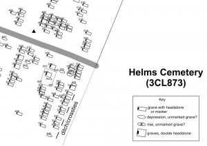
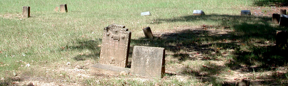
A starting point for the grave mapping project was a list of individuals buried here based on the published cemetery census. The Clark County Historical Association has published a five-volume set of books on cemeteries in the county that includes documentation of names and inscriptions from gravestones.
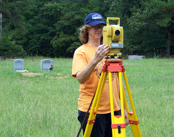
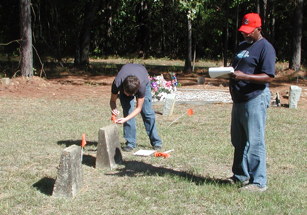
Over four field days in September and October, 2010, we mapped grave markers, graves, family plot corners, and possible graves within Helms Cemetery. Each gravestone or possible grave was flagged, shot in with the total station, matched to the CCHA list of individuals named on grave markers, and photographed. The result is that the map, the photographs, and the cemetery census can all be tied together.
![""](https://archeology.uark.edu/wp-content/uploads/2015/08/DHC_Peakeobelisk500-1.jpg)
![""](https://archeology.uark.edu/wp-content/uploads/2015/08/DHC_Trubittattotalstation600-1.jpg)